Winter Weather Advisory: NJ’s first real snow event of the season
UPDATE... This article is outdated...
For the latest winter storm forecast information, please refer to my newest weather blog post.
The Bottom Line
So far, we have called Sunday's impending storm system "snow big deal". And that description still applies, for the vast majority of New Jersey. But to the north, the forecast has trended snowier. (In addition to earlier and heavier.) So it's time to ring some alarm bells for tricky travel for approximately the northern third of the state.
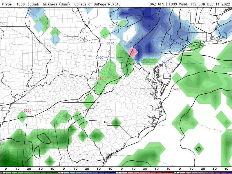
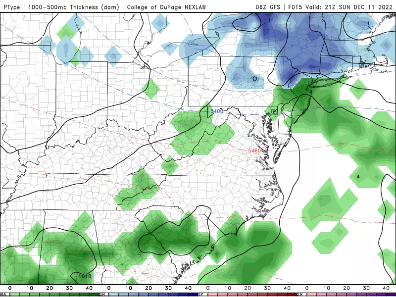
Initial raindrops and snowflakes are starting to arrive as I type. Spotty to scattered stuff at first. Then the "brunt" of the storm will be Sunday afternoon through early evening (2 p.m. to 7 p.m.) Lingering showers will carry through Sunday night, drifting south. Precipitation will not wrap up completely until mid-morning Monday (10 a.m.)

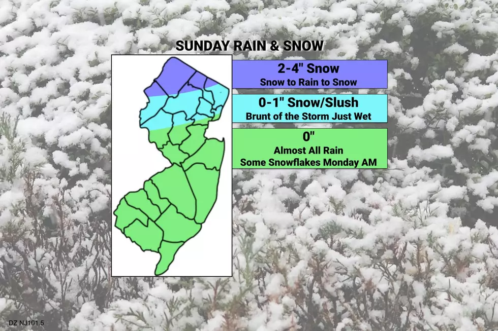
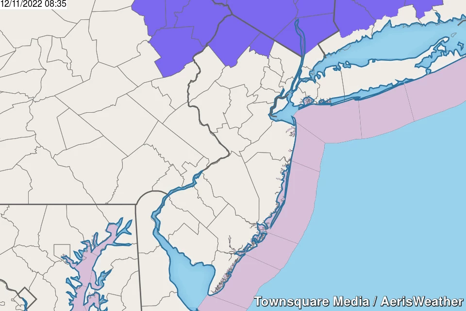
The Snow Zone: Along and North of I-80
This is going to be a "mainly snow" event along the northern edge of New Jersey. It will probably be the first time this season with over 2 inches of accumulation — what I informally call a "snow event".
Initial precipitation arriving Sunday morning will be scattered snow showers. As a heavier band arrives Sunday afternoon — the "brunt" of the storm — snow will likely mix with (or flip to) rain. And then, as temperatures drop again Sunday evening, another period of all (light) snow will carry through Sunday night.
My estimate for total snowfall is 2 to 4 inches, approximately along and north of Interstate 80. Accumulations will be affected by how warm and wet the ground is. So grassy, unpaved, cold surfaces will be the snowiest, as usual. Treated roadways should fare pretty well.
Some models have spit out raw snow totals as high as 9 inches — but that seems bogus. I suppose the potential for over 4 inches exists, if a heavier snow band sets up in just the right spot. (Especially if this turns into an "all snow" event for North Jersey, which is also a possibility.)
The National Weather Service has issued a Winter Weather Advisory for Sussex County from 7 a.m. Sunday to 7 a.m. Monday, and for Passaic County from 10 a.m. Sunday to 7 a.m. Monday. Advisories are issued when wintry weather may cause slippery, challenging travel conditions.
Mixed Bag: Between I-80 and I-78 Corridors
The most uncertain piece of this forecast puzzle unfortunately falls over the highly populated and heavily traveled "rest of North Jersey".
I am not worried about this section of the state getting "buried" in snow. I do think some snowflakes are likely, especially early and late Sunday. The "brunt" of the storm from Sunday afternoon through early evening looks like just plain rain.
So accumulations will be limited. You may find a healthy coating in spots, especially on grassy, unpaved, colder surfaces. It will be "slushy" rather than "icy," especially given the rain involved in this forecast too.
No advisories or major alarm bells here. Just be aware of changing weather conditions, and be cautious of slippery roads.
Mainly Rain: South of I-78
As of this writing, temperatures across central and southern New Jersey are above freezing. Primarily in the 40s, in fact. Too warm for snow through Sunday morning and afternoon. So expect a wet day, with rainfall totals possibly reaching (or exceeding) a half-inch.
Things could get more interesting Sunday night, as temperatures drop. Model guidance has been very consistent in showing one last band of showers diving south along the Jersey Shore through Monday morning. There is a good chance that will be snow. Or at least wintry mix.
Accumulations? Minimal. Maybe a dusting. But the ground will be insulated by the wetness and warmth of Sunday's weather. Don't expect much, if anything.
Wet roads are not as treacherous as icy or slushy ones. However, there could still be some problems with slipping and sliding, misty conditions, and low visibility through Monday morning's commute.
Other Concerns
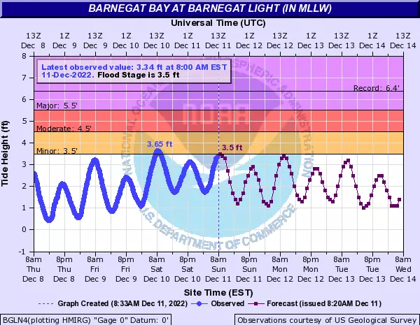
We are experiencing one more round of minor coastal flooding along the Jersey Shore Sunday morning. (Cresting closer to midday for back bays and tributaries.) A foot of surge may cause some water issues in the "usual" vulnerable spots near tidal waterways.
Following this minor winter storm, we are not expecting any "extreme" cold or "dangerous" wind chills. Having said that, be prepared to bundle up for the foreseeable future. Temperatures are going to be stuck below normal all week — 20s in the morning, barely 40 degrees in the afternoon.
The Next One
Another, more powerful storm system is showing up at the end of the 5 Day Forecast — Thursday into Friday. It's still too early for confident details. (Especially since I like to tackle winter storms one at a time.) But I will give three important bullet points for now:
1.) Snowfall could be significant to the north and west.
2.) Once again, it will not be all snow — rain will be predominant to the south and east.
3.) Both the potential snow and rain look more impactful than the current Sunday-Monday storm.
Bottom line: This is absolutely the next thing to watch. But no need to go crazy just yet. We will keep you posted as the week goes on, with forecast details becoming much clearer by midweek.
Dan Zarrow is Chief Meteorologist for Townsquare Media New Jersey. Follow him on Facebook or Twitter for the latest forecast and realtime weather updates.
First flakes: When does snow season start in NJ?
Let it snow: 12 things to know about winter forecasting in NJ
More From Beach Radio