A quick shot of rain-snow for NJ, Tuesday afternoon and evening
Greetings from my first day of paternity leave! I've decided to hold on to the weather blog reins for an extra day, as there is a legitimate chance of minor snow accumulation in the forecast. While this is not expected to be anywhere near a major winter storm for New Jersey, there are some nuances and difficulties in the forecast that require some extra analysis and explanation.
Background
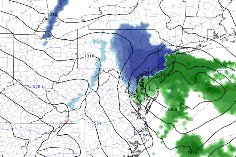
A fast-moving, compact storm system will arrive in New Jersey on Tuesday. There are a number of important forecast factors to soak in here. The speed and size of the storm, plus initially above-freezing temperatures, will limit snow accumulations. But falling temperatures and the chance for heavier precipitation bands could contribute to inflated snow totals and travel headaches.
Some model runs have painted a pretty snowy situation for inland South Jersey in particular. I don't fully buy that idea. But that is the area of the state we're eyeballing for the heaviest, steadiest precipitation later on.
A Quiet Start
Tuesday is starting off quiet, with chilly temperatures averaging about 30 degrees across the Garden State. We'll see cloud cover Tuesday morning, thickening up further by Tuesdat midday. High temperatures Tuesday afternoon should reach the lower to mid 40s across most of the state — that will be a very important piece of the puzzle here.
Bring on the Rain and Snow
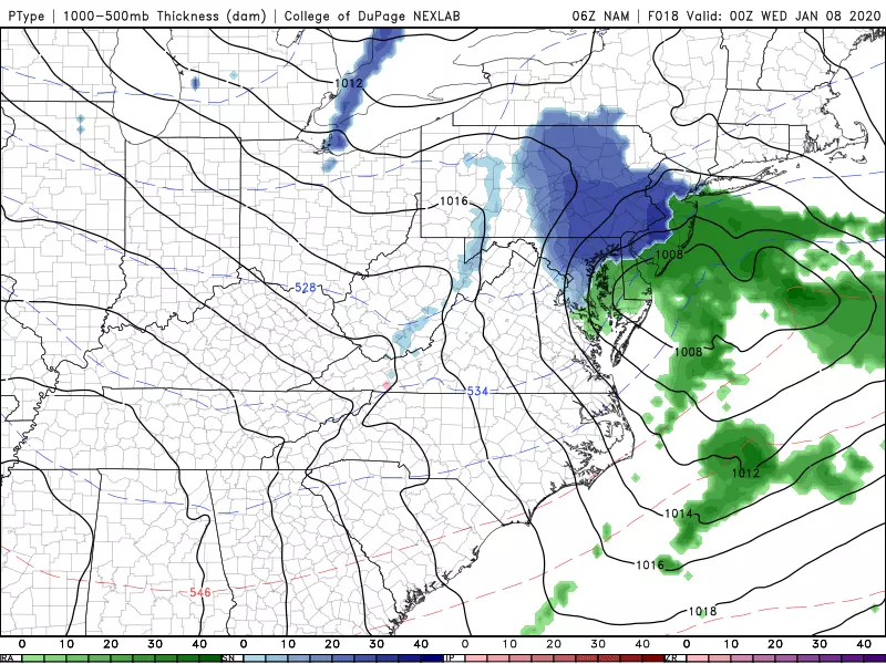
Our storm system will arrive from the southwest around 2 p.m. Tuesday, with potential weather impacts lasting through about Midnight Tuesday night.
Because of that arrival timing, with forecast temperatures well in the 40s (and therefore well above-freezing), we're initially looking at a period of light to moderate rain. Again, starting in SW NJ and spreading to the north and east as the evening commute approaches.
Eventually, three triggers are going to force temperatures to fall from those lofty 40s, eventually causing a changeover from rain to snow:
1.) Nightfall (sunset is still very early, around 4:45 p.m.).
2.) Raindrops cooling the air, through evaporative cooling.
3.) Cold air being pulled down on the back half of this storm system.
As usual, timing is everything here. This storm system's prime time (the period of heaviest rain and/or snow) between about 6 p.m. and 10 p.m.
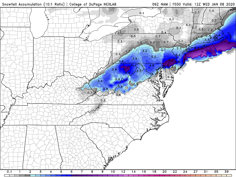
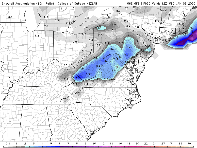
How Much Snow?
Raw model output has pushed out snow totals as high as 6 inches for inland South Jersey. Yikes. The mesoscale NAM model currently shows the highest solution. But that model erroneously assumes an all-snow situation at onset. That ain't gonna happen. Unless this storm system really gets fired up and dumps some heavy snowfall after sunset — not completely out of the question — we can at least halve those snowfall estimations.
The Bottom Line
So here's the forecast, breaking the state into 4 regions:
Inland South Jersey
(including western Ocean and western Atlantic counties, to the Interstate 295 corridor)
Light rain Tuesday afternoon will eventually turn to a period of snow Tuesday evening. An inch or two of snow accumulation seems likely. Higher amounts are possible here if heavier snow bands set up. Whether it's rain, snow, or a bit of both, Tuesday evening's rush hour will be impacted by the weather.
The Jersey Shore
(especially along and east of the Garden State Parkway)
Rain arrives late Tuesday afternoon, with a brief changeover to snow possible Tuesday night. Light accumulations, on the order of a healthy coating, will be possible on grassy and colder surfaces. But warmer temperatures will make this a mainly wet event for you.
Central Jersey
(generally from the Interstate 195 corridor to about Interstate 78)
You'll be right on the edge of the heaviest precipitation bands. If temperatures fall fast enough Tuesday evening, a quick coating to maybe an inch of snow accumulation is possible here. There could be some travel impacts for your evening commute, as we'll be right on the precipice of that rain-snow transition.
North Jersey
(especially along and north of Interstate 78)
This really isn't your storm, as most (if not all) precipitation bands remain to the south. However, temperatures both at the surface and aloft may be cold enough to support snow for the duration. And a colder ground would be more susceptible to that snow sticking. So, if the storm system wiggles to the north slightly, or if an errant heavier snow band strays farther north, you could still see some wintry weather by Tuesday night.
Please understand this is a very tricky forecast situation, where it literally can come down to a few miles and a few degrees. In any case, this almost certainly looks like a "minor" snow event for New Jersey. (The only exception to that statement, and source of my hesitation here, is the slight possibility of 2+ inches of snow in South Jersey.)
Winter Weather Advisory
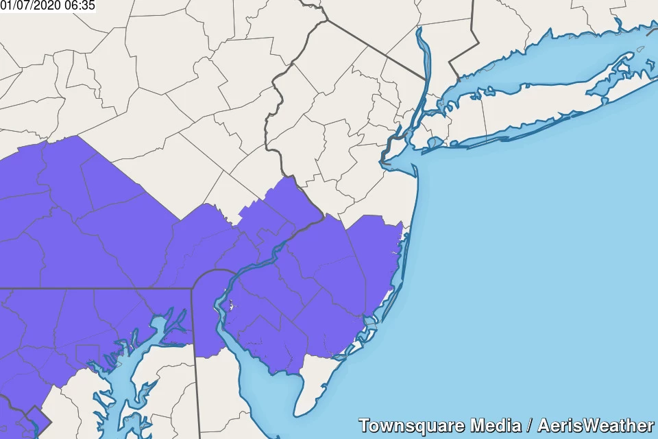
A late-breaking Winter Weather Advisory has been issued for inland South Jersey from 5 p.m. to Midnight. The advisory covers Burlington, Camden, Gloucester, Salem, Cumberland, inland Atlantic, and inland Ocean counties.
The geography is spot on, but I'm not sure we'll reach advisory-criteria snow (3+ inches). Better to be safe than sorry, I suppose.
The Rest of the Week
After the final flakes fly Tuesday night, skies will clear into Wednesday as a strong northwesterly wind returns. Gusts to about 35 mph will certainly make for a blustery Wednesday. Especially with high temperatures only near 40 degrees. (That will put the wind chill around 30, at best.) A few snow showers will be possible during the day Wednesday too.
Thursday looks cold, but less windy. And then we'll start a big warmup through the weekend. 40s Friday. 60s Saturday! The warmth will come with clouds and scattered rain showers, although no day even comes close to a washout.
Our next outright storm system arrives Saturday night — a cold front that will produce one more burst of rain, and then drop temperatures dramatically. While 60s will be possible early Sunday morning, thermometers will probably nosedive into the 30s (maybe even 20s) by Sunday afternoon. Brrr!
In Summation
Could this be New Jersey's third official snow event of the 2019-20 winter season? (Defined as at least one 2+ inch report in the state.) Maybe. Again, this little snow makers are hard to pinpoint, because there are so many limiting factors in play.
I've decided the meager snowfall forecast is not high enough to make a full-blown snow map.
In conclusion, skip the shopping trip for bread and milk. But be prepared to exercise common sense and patience Tuesday evening.
More From Beach Radio