NJ weather: Warm and humid, then stormy, then damp and dreary
The Bottom Line
For the fifth day in a row, we'll see widespread 80s across New Jersey on Wednesday. Feeling much more like mid-July than mid-September.
But some changes are on the way, thanks to an approaching cold front and a coastal storm system (which may become a named tropical storm). An extended 48-hour period of unsettled, cloudy, occasionally wet weather is on the way for New Jersey. And there is a risk for pockets of heavy rain and severe weather - but it is pretty limited.
Then it looks like the pendulum will swing back to brighter, drier, warmer weather just in time for the final weekend of summer.
Wednesday
Very warm and humid. Then stormy.
Wednesday morning is starting out near 70 degrees. We've got some light patchy fog around, but nothing that will get in your way.
High temps will push into the mid to upper 80s Wednesday afternoon. That's running almost 10 degrees above normal for this time of year. Plus, with dew points close to 70, it's going to be quite humid too.
While the day will begin with sunshine, clouds will steadily increase. A stiff breeze out of the south could gust over 20 mph.
New Jersey will stay dry during the daytime hours Wednesday. But an approaching cold front will push in showers and thunderstorms starting Wednesday evening.
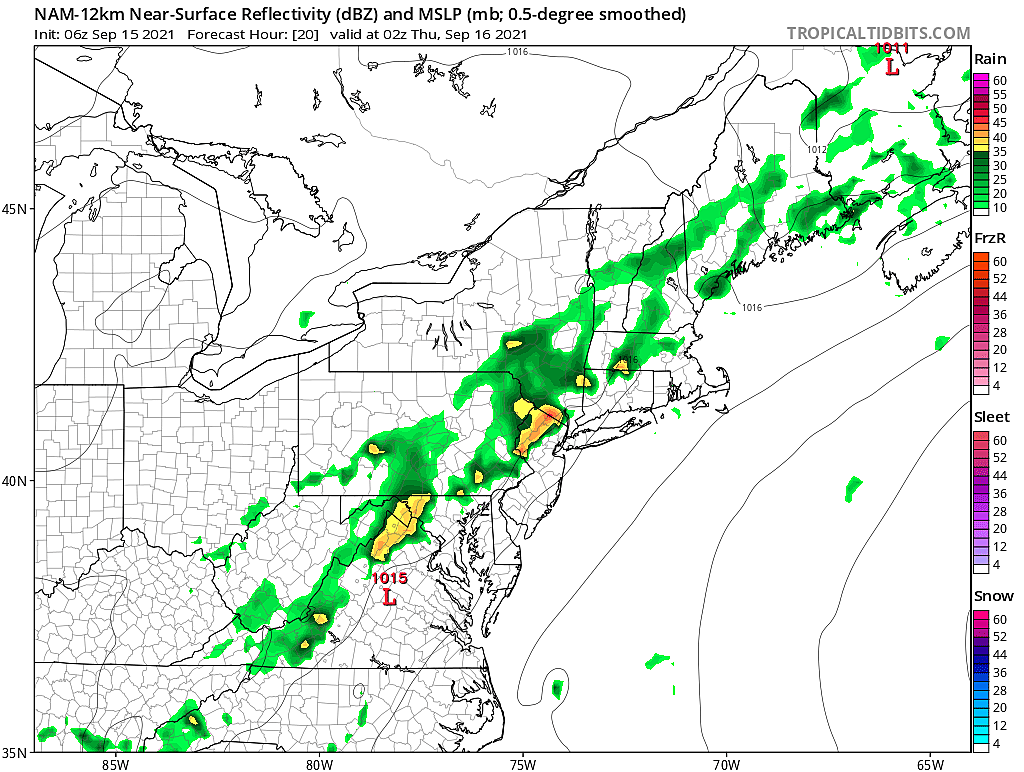
I am a bit worried about the initial burst of storms, expected to arrive in NW NJ around 8 p.m. A burst of gusty wind could suddenly kick up just ahead of the thunderstorms. And heavy rain is possible too. If those storms are slow movers, it could lead to localized 1 to 2 inch rainfall totals.

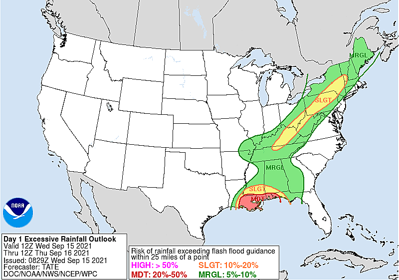
So the severe weather and flooding risk will be localized, but it's absolutely worth mentioning.
Storms will fade in intensity by about Midnight, but scattered showers will spread through the rest of the Garden State overnight. Low temperatures will dip into the upper 60s or so.
Thursday
Damp and dreary.
A big driver of our rain for Thursday and Friday will be a coastal storm system, passing about 250 miles southeast of New Jersey. That system is starting to show tropical characteristics, and may become a named tropical storm at some point. (The next names on the 2021 Atlantic list are Odette and Peter.)
Because of how complicated this forecast is, and how light the rain will be, I can't really pinpoint a timeline of when it's going to rain and when it's not on Thursday. So I've opted to call it "occasional showers". Total rainfall on Thursday will likely stay below a quarter-inch. Skies will be mostly cloudy to overcast. And it's going to feel pretty sticky too.
High temperatures won't make it past the upper 70s due to the clouds and raindrops.
Friday
Still damp and dreary.
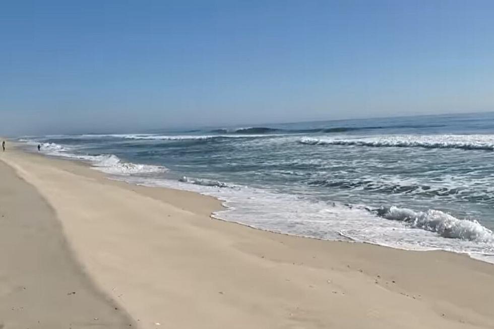
To be clear, I'm not worried about a "direct" landfall from that coastal storm, whether it gets a name or not. Rip currents and rough surf are good bets. And some models do show a closer wiggle toward New Jersey, which could drive in some steady rain around midday Friday. But that's not a guarantee.
At the very least, we'll see more clouds and showers on Friday. With highs in the mid 70s.
The Weekend & Beyond
If all goes well, and the Thursday-Friday timing and track play out as expected, we'll see big improvements for the last weekend of summer.
Saturday will progress from clouds to sun as we dry out. Thermometers will warm up again into the 80s. Both Saturday and Sunday will be warm and humid and summerlike.
The bright, warm weather is expected to continue through at least the first half of next week too. Highs will generally hit 80s for the foreseeable future.
As we fall into autumn, we will eventually see an intrusion of colder, drier, more autumnal air. The transition will probably be sudden. But that change is not even on the distant horizon at this point.
There is one more thing to watch: A strong tropical wave just off the coast of Africa. The trajectory and latitude makes a U.S. impact possible about 10 to 14 days from now. It's still 3,600 miles from New Jersey though - a long way to go.

Dan Zarrow is Chief Meteorologist for Townsquare Media New Jersey. Follow him on Facebook or Twitter for the latest forecast and realtime weather updates.
New Jersey at different points in world history
Inside look at NJ oasis: The Flying W Airport
Gallery Credit: Dennis Malloy
More From Beach Radio