NJ weather: Timeline for Saturday thunderstorms and big cooldown
The Bottom Line
Don't be caught off-guard by the significant transition coming to New Jersey's weather on Saturday, driven by a strong cold front pushing in from the west. The day will begin where Friday left off — sunny, windy, and warm. But thunderstorms will roll in suddenly Saturday afternoon, leading to a brief period of heavy rain and gusty wind. to stormy, windy, and much cooler. By Sunday morning, we "fall" back into more typical, more seasonable autumn weather.

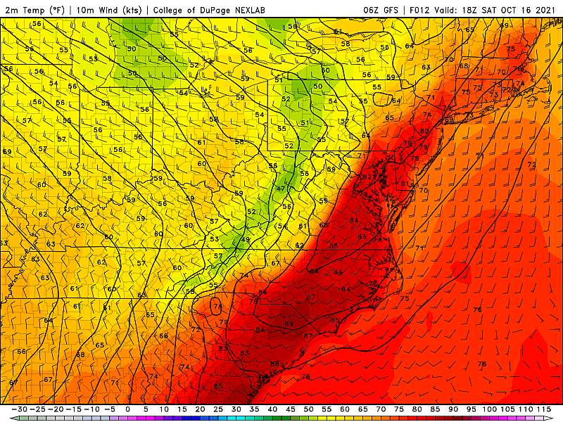
Saturday Part 1: Sunny, Windy, Warm
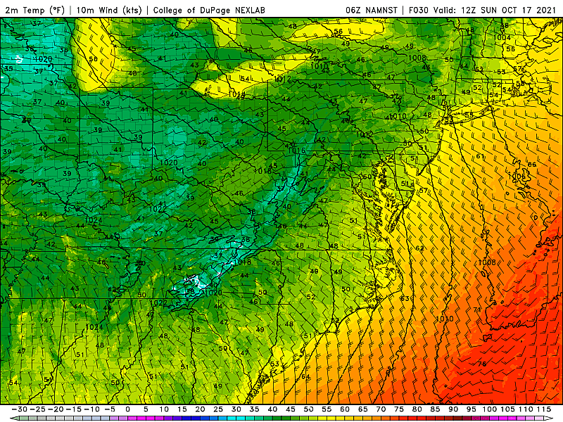
—Temperatures? Sticky 60s in the morning, akin to a nice summer start. Highs should reach the upper 70s to around 80 degrees for most of the state by Saturday midday/afternoon. Still incredibly warm for mid-October, almost 15 degrees above normal.
—Cloud cover? Mostly sunny to start, with clouds increasing through the midday and afternoon hours. Skies should remain fair and bright until storms arrive.
—Wind gusts? Pre-front, southerly winds will occasionally top 20 mph. Making it a bit windier and more blustery than the other days of this warm stretch.
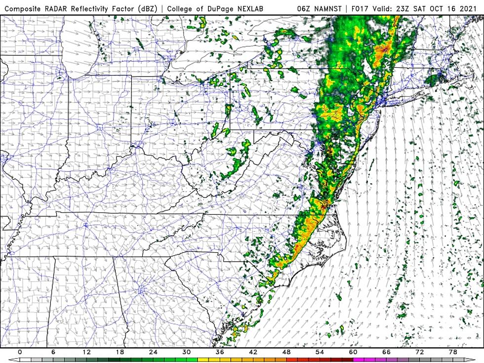
Saturday Part 2: Thunderstorms
—Start time? A line of thunderstorms will crash across the Delaware River between about 3 p.m. and 5 p.m. Scattered showers and storms should reach the Jersey Shore between about 6 p.m. and 8 p.m.
—End time? Rain should taper in western NJ between 9 p.m. and 11 p.m. Eastern NJ will dry out between about Midnight and 3 a.m.
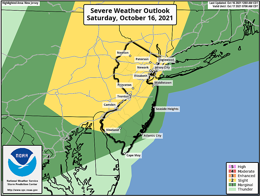
—Biggest concern? Yes, there is a risk for flash flooding if over a half-inch of rain falls in a short period of time. Yes, this squall line could produce some gusty winds — almost certainly "strong" to 40 mph, possibly "severe" over 60 mph. Yes, there's even a chance for an isolated tornado. (The highest risk for all of those severe weather elements will be to the north and west right at onset, by the way.) But my biggest concern is that many New Jerseyans will be caught completely by surprise by the quick entrance of stormy weather. Knowledge is power — please plan your day accordingly, and tell your friends.
Saturday Part 3: Cooldown
—When? Saturday afternoon's thunderstorms will knock back temperatures quickly, due to rain-cooled air. Once rain comes to an end Saturday night, a northwest wind will kick up, possibly gusting over 30 mph. Cooler, drier air will "whoosh" in on that brisk wind.
—How cool? By daybreak Sunday morning, low temperatures will dip into the mid to upper 40s in northwestern New Jersey. Most of the state will hit lower 50s. It will be our coolest morning in exactly two weeks.
—Any big problems? If temperatures really crash in NW NJ, into the 30s, there is a chance for some patchy frost. That will be an increasing concern for farmers and gardeners as the week goes on, with chilly mornings and cool afternoons our new "usual".
The Extended Forecast
Highs on Sunday will only make it to the lower 60s. That is a full 15 to 20 degrees cooler than Friday and Saturday, and slightly below normal for mid-October. It will still be breezy too, with a northwesterly wind at 10 to 20 mph throughout the day.
For the most part, next week will feature dry, sunny, seasonable autumn weather. Morning lows dipping into the 40s. Afternoon highs mainly in the 60s. Low humidity, and not a drop of rain to be found.
Our next storm system will be a late-week cold front, in the Thursday-Friday time frame. Whether we get any rain or big cooldown from that is unclear — we'll piece that puzzle together as it gets closer.
Stay cool. Stay safe. Stay dry. Stay warm. And have a great weekend!
Dan Zarrow is Chief Meteorologist for Townsquare Media New Jersey. Follow him on Facebook or Twitter for the latest forecast and realtime weather updates.
Best NJ corn mazes, pumpkin patches, hayrides for 2021
Red flags for someone who claims to be from New Jersey
Gallery Credit: Kylie Moore
More From Beach Radio