

NJ weekend weather: Wet, then windy, then colder
The Bottom Line
It's raining again. As we have discussed all week, this weekend's forecast includes a one-two punch of wet weather. First, a coastal storm drives in showers and thunderstorms on Friday, especially along the eastern half of the state. Second, a cold front will push through one more batch of rain early Saturday, followed by a burst of wind and another big cooldown.
Despite the inclement, less-than-perfect weather outlook, I feel like I need to scream it from the mountaintops: This weekend will not be a total washout! Friday will be wet. Saturday will start wet. And the rest will just be blustery.
By early next week, temperatures will take another step downward. It's going to feel pretty November-ish for a few days, with morning lows in the 30s and afternoon highs in the 50s.

Friday
As of this writing (9 a.m.), we have already picked up over a half-inch of rain along the coast. Friday's rain is front-loaded — the spread of rain should dial back a bit through the afternoon and evening hours. But I have to leave raindrops in the forecast through at least sunset. And there could be some downpours and rumbles of thunder along the way.
Again, this is a coastal storm system. So the wet weather impacts will be felt most along the eastern edge of New Jersey. (I cant "just" say the Shore, as models actually show the urban center of NE NJ to be the wettest in the state.) Total rainfall over an inch is possible. While there could be some localized ponding issues, I doubt we are looking at any dangerous flash flooding or severe weather here.
Despite the rainy forecast, you may actually catch some breaks of sun in the afternoon. (Especially across inland areas.) High temperatures should be similar to Thursday, in the 60s.
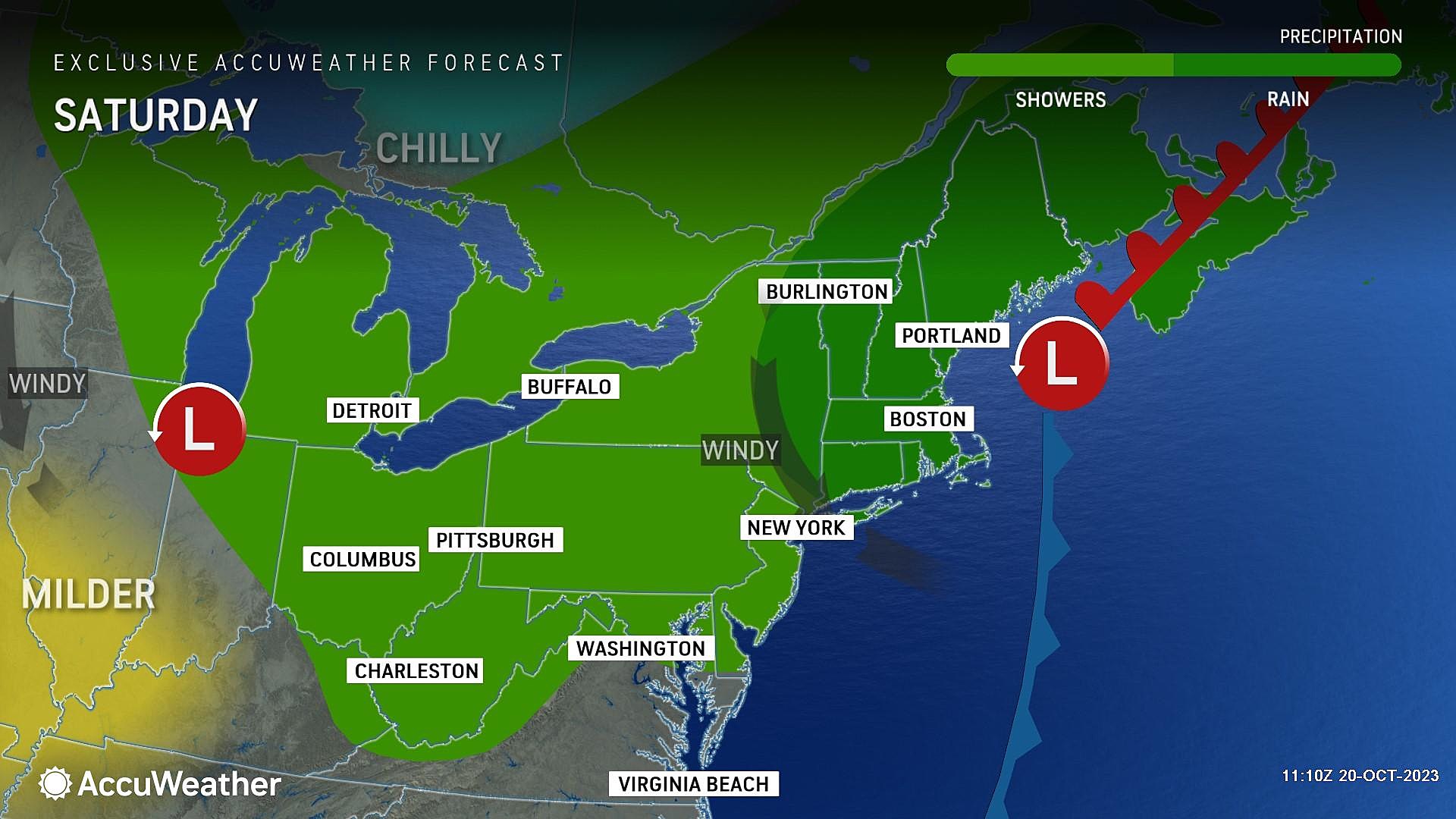
Saturday
Saturday is one of those "transition" days. Starting wet, ending dry. Starting calm, ending windy. Starting mild, ending chilly.
The big struggle with this forecast is pinpointing the end time of potential rain on Saturday. Some model guidance has shown a distinct drying trend as of about 8 a.m. But the consensus seems to keep spotty showers over much of New Jersey until midday or even early afternoon.
In any case, rain on Saturday looks light and scattered — no downpours or thunderstorms this time around. I do not expect additional rainfall totals to exceed a quarter-inch.
Even though the second half of Saturday turns dry, a new concern pops up: A gusty west-northwest wind. It looks like top gusts will reach about 35 mph. Not quite high enough to call it "damaging". But definitely blustery and a nuisance. Especially since that wind will be responsible for our impending cooldown. (More on that in a moment.)
Skies will remain mostly cloudy through Saturday afternoon too. High temperatures should come close to 60 degrees, but thermometers may start falling off as that cooler air mass arrives.
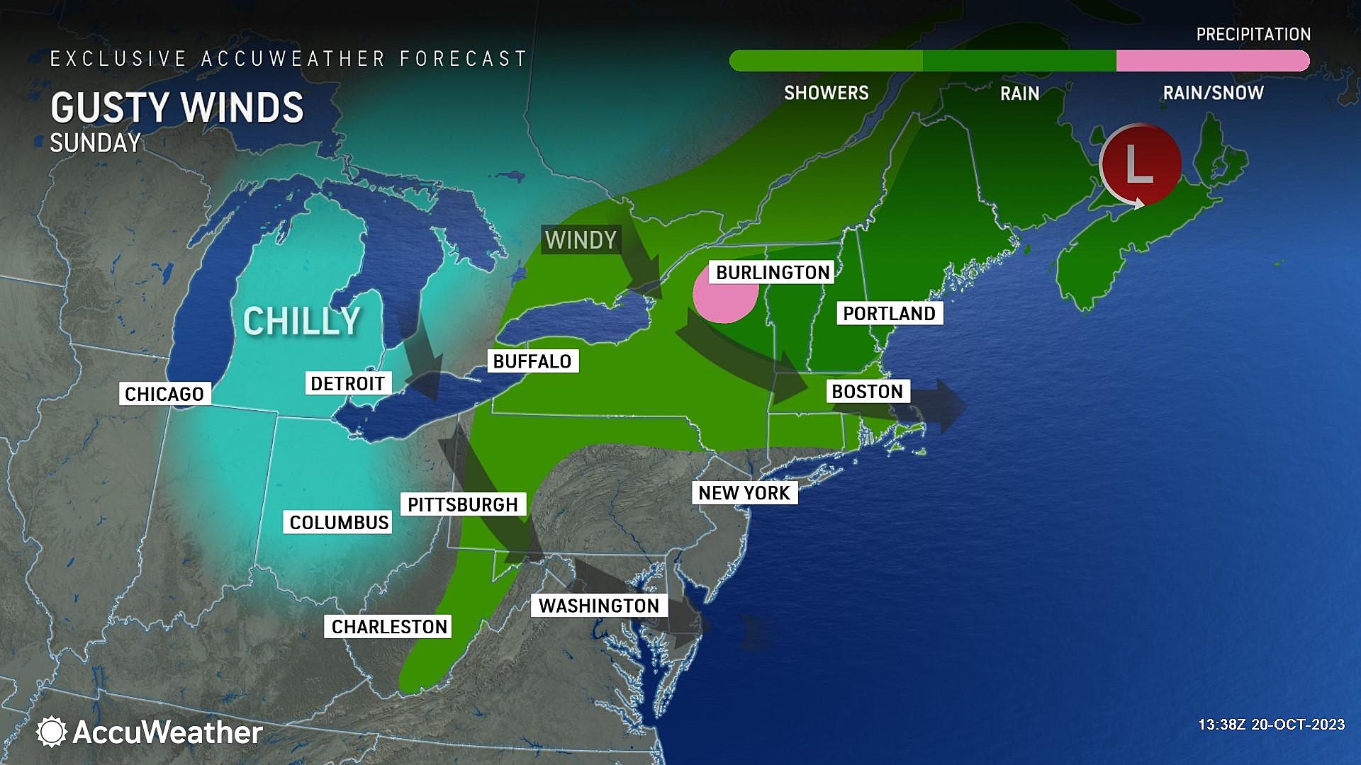
Sunday
I'd like to call Sunday completely dry. However, a couple model runs have suggested an isolated shower in far northern New Jersey. So let's call it "mainly" dry, just to be safe.
Bottom line: Sunday is going to be a windy day, with regular gusts in that 30-35 mph range. Peeks of sun will not do much for temperatures, as we will be stuck in the 50s all day. Again, that would be typical in mid-November — but not so much in mid-October.
Monday & Beyond
The breeze will subside on Monday, and skies will be bright and sunny. However, temperatures will stay on the cool side of normal. We're watching the potential for our first widespread frost of the season on either Monday morning or (more likely) Tuesday morning. Daytime high temps will probably end up on either side of 60 degrees.
Dry, sunny weather will persist through midweek, as a warming trend kicks in. If all goes well, thermometers could shoot well into the 70s by late-week. What a difference from this weekend's chilly, damp, dreary weather!
Season ends soon for NJ camping: Last days to reserve in 2023
Gallery Credit: Mike Brant
Dan Zarrow is Chief Meteorologist for Townsquare Media New Jersey. Follow him on Facebook for the latest forecast and realtime weather updates.
NJ street fairs return for the 2023 fall season
Gallery Credit: Mike Brant