Winter Weather Advisory for NJ: Light freezing rain Wednesday AM
UPDATE... This article is outdated...
For the latest winter storm forecast information, please refer to my newest weather blog post.
Now that it's January, cold air is pretty much here to stay. So we always have to be vigilant to the threat of wintry, icy weather.
And we've got such a chance for Wednesday morning. A little one.
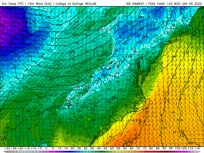
Spotty showers are expected to develop after Midnight Tuesday night, lasting through about midday Tuesday. The best chance for showers will be along the eastern half of New Jersey. (So mainly the coast).

This storm system will be accompanied by rising temperatures. So a massive winter weather event is not expected here — what falls from the sky will be primarily liquid rain.
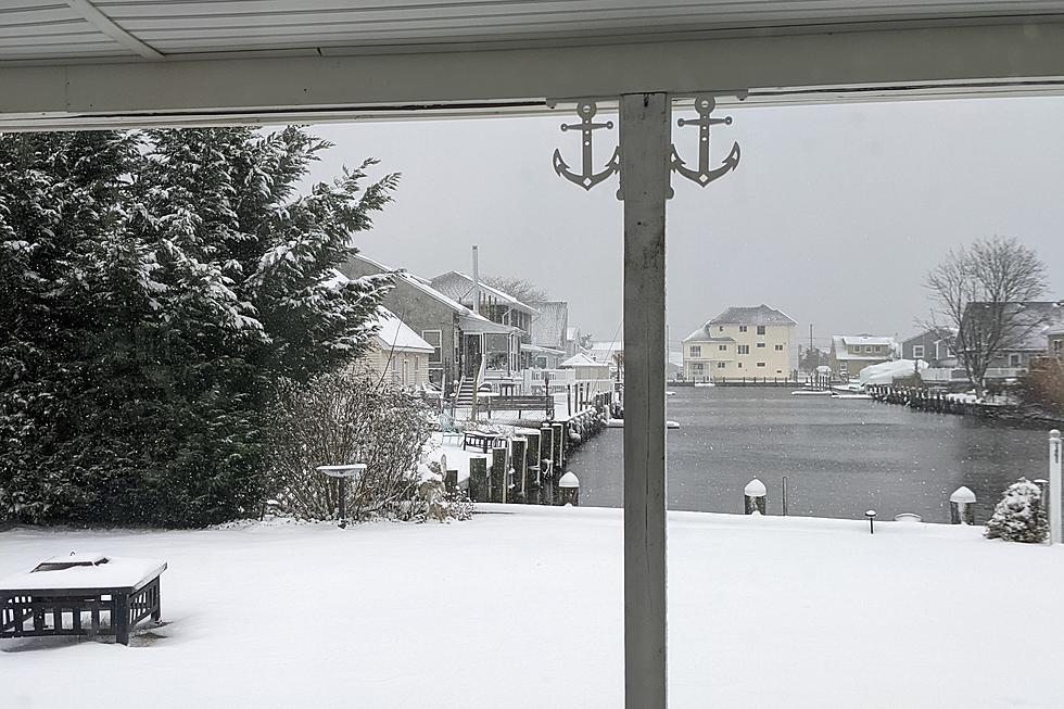
Having said that, the ground is cold. Freezing cold. Especially in southern New Jersey, which still has substantial snow cover around.
When liquid raindrops hit a freezing cold surface, they freeze on contact. And that is what we call freezing rain.

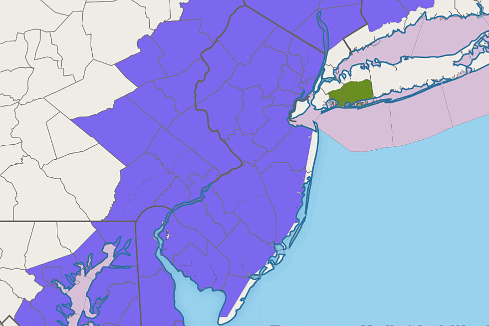
There is a possibility of some icy mix and/or freezing rain Wednesday morning. (Maybe some non-accumulating snow and sleet too.) So the National Weather Service has issued a Winter Weather Advisory for all of non-coastal New Jersey, for the following times:
—South and coast... inland Atlantic, Burlington, Camden, inland Cape May, Cumberland, Gloucester, inland Ocean, and Salem counties... 5 a.m. to 9 a.m. Wednesday
—North and west... Hunterdon, Mercer, Middlesex, inland Monmouth, Morris, Somerset, Sussex, and Warren counties... 7 a.m. to Noon Wednesday
—North and east... Bergen, Essex, Hudson, Passaic, and Union counties... 4 a.m. to 10 a.m. Wednesday

By definition, a Winter Weather Advisory cautions that travel could become hazardous due to the weather. In this case, the risk is for a light glaze of ice — it doesn't take much icing to make things very slippery.
As I've mentioned online and on-air, I'm not overly concerned. And I don't want to make a big, hairy deal of this minor storm system. But there is a chance for icy spots, during the morning commute, so it's definitely worth the heads up. Watch your step, and drive carefully.
We are still monitoring a much more impactful chance of snow coming up Thursday night into Friday morning. The big question: Will it be a "1 to 3 inch" or a "3 to 6+ inch" event? We'll talk more about that in the coming hours and days.
Dan Zarrow is Chief Meteorologist for Townsquare Media New Jersey. Follow him on Facebook or Twitter for the latest forecast and realtime weather updates.
LOOK: Food history from the year you were born
Gallery Credit: Joni Sweet
11 things that make a New Jersey diner a real diner
Gallery Credit: Jeff Deminski
More From Beach Radio