NJ’s next rainmaker storm system will play out in three parts
The Bottom Line
There is only one stumbling block in New Jersey's weather forecast: An area of low pressure that will track overhead from Thursday into Friday. The forecast hasn't changed much, as warm air forces a wet (not wintry) situation. But there are some nuances here, as the system plays out in approximately three parts.
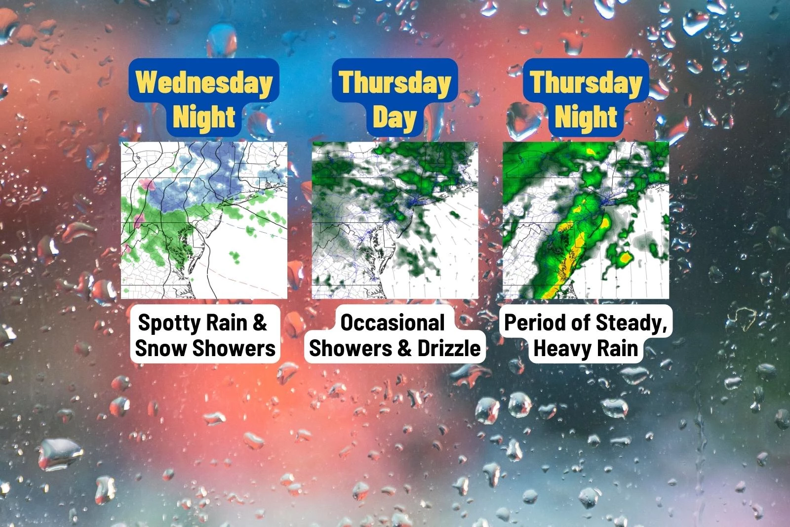
1.) Getting started: Spotty showers and fog Wednesday night. Conversational snowflakes are possible, briefly, to the north.
2.) A blah day: Occasional showers and drizzle during the day Thursday.
3.) The brunt of the storm: A period of steady, heavy rain Thursday night through early Friday morning.
We will then dry out, clear out, and cool down again on Friday. That will set us up for a quiet, sunny, and seasonably chilly January weekend.

Wednesday
The cloud cover broke apart a bit overnight. And where that happened —especially to the south and west — temperatures have crashed into the 20s. A colder-than-expected start to the day there. Closer to the coast and NYC, we are in the 30s.
You will catch peeks of sunshine early on Wednesday, before clouds take over the sky once again through the afternoon. The air is still bone dry. Winds will stay light. And temperatures will be seasonably cool, peaking in the lower 40s.
Wednesday Night
As low pressure slowly approaches from the west, the outer bands of precipitation may spark a few showers and sprinkles over New Jersey. Some models put raindrops over us as early as 4 p.m. Wednesday afternoon. But I favor a later arrival time, after sunset.
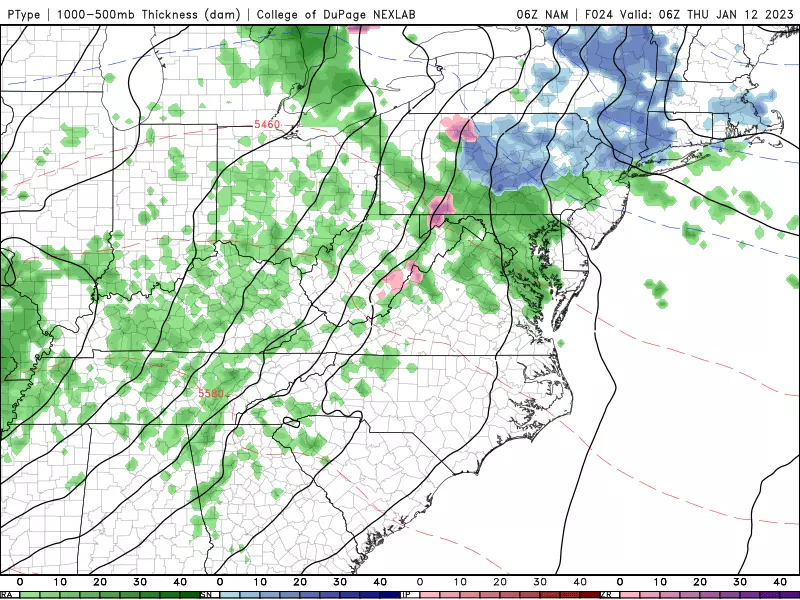
Low temperatures will dip into the lower to mid 30s overnight. Most of New Jersey will stay enough above freezing that wintry weather is unlikely. But north of Interstate 78, a brief period of light snow is possible — however, I am not worried about accumulations or travel impacts. Around sunrise Thursday, temperatures should warm enough that the rest of the storm's impacts will be solely liquid in nature.
Thursday
Just a blah, unsettled day. We'll see cloudy skies and occasional showers, drizzle, and fog. The day will not be a total washout, with substantial breaks of dry weather. Just not very pretty.
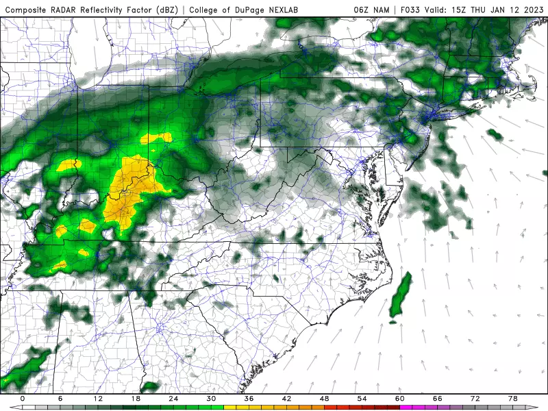
Meanwhile, warm, most air will be flowing into our atmosphere. Temperatures and dew points will both rise into the 50s by Thursday evening.
Thursday Night
The steadiest, heaviest rain of this system — really the only "washout" period — will be between about 10 p.m. Thursday and 5 a.m. Friday. It may really pour for a few hours overnight.
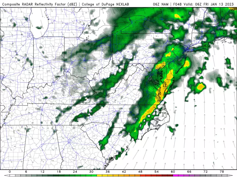
Most rainfall estimates end up between a half-inch to an inch. The wettest part of the state will be northern NJ. There have been a few model runs suggesting some downpours and much higher totals (2+ inches), so that is a possibility we will have to watch.
Friday
Rain should wrap up completely by daybreak Friday morning. It should be a clean stop — I do not think we'll see lingering, residual showers.
Amid clearing skies, a brisk westerly wind Friday will start to push temperatures downward again. Nailing the exact thermometer trend is difficult. We'll probably be in the lower to mid 50s just after Midnight Friday morning. Then settling in the mid to upper 40s around daybreak. A brief spike to around 50 degrees is possible through midday. Then we'll see widespread lower to mid 40s by sunset.
By Saturday morning, we'll probably drop below freezing into the 20s and 30s.
The Weekend & Beyond
For the extended MLK weekend, our weather settles down again as we fall back into a seasonable ("par for the course") pattern.
Both Saturday and Sunday look bright and sunny, with high temperatures both days in the lower 40s.
I could see mid 40s on Monday, with light winds and late clouds.
There are a couple of storm systems showing up in long-range forecasts next week, with a chance of a shower on Tuesday and then steadier stuff late-week. Still no big snow (or even medium or little snow) on the horizon yet.
Dan Zarrow is Chief Meteorologist for Townsquare Media New Jersey. Follow him on Facebook or Twitter for the latest forecast and realtime weather updates.
LOOK: The biggest scams today and how you can protect yourself from them
See the Must-Drive Roads in Every State
Gallery Credit: Sarah Jones
More From Beach Radio