NJ’s big thaw: Warming temperatures, mainly dry weather this week
The Bottom Line
Before we talk about a warmer, happier forecast, let's look at where we've been. As promised, this was one of New Jersey's coldest Christmases on record. On Saturday (Christmas Eve), the high temperature at the top of High Point was 5 degrees. That's the warmest it got all day. With a biting wind. Yikes.
So we are already doing better than that. Temperatures have been stuck below freezing for 90+ continuous hours at this point. But most of NJ will pop above 32 degrees Tuesday.
And then it gets even warmer. 40s. 50s. Even 60s? Furnaces and parkas alike will get a welcome break across the Garden State.
Plus, we will enjoy mainly dry weather throughout this final week of the year. Our next chance of widespread rain may impact your New Year's festivities next weekend.

Tuesday
There is a bank of clouds drifting over New Jersey to start this Tuesday. That "blanket" overhead actually prevented temperatures from crashing too far. We're in the 20s across almost the entire state. Seasonably chilly. Watch for patches on black ice still out there, especially on shoulders, ramps, bridges, overpasses, and side streets.
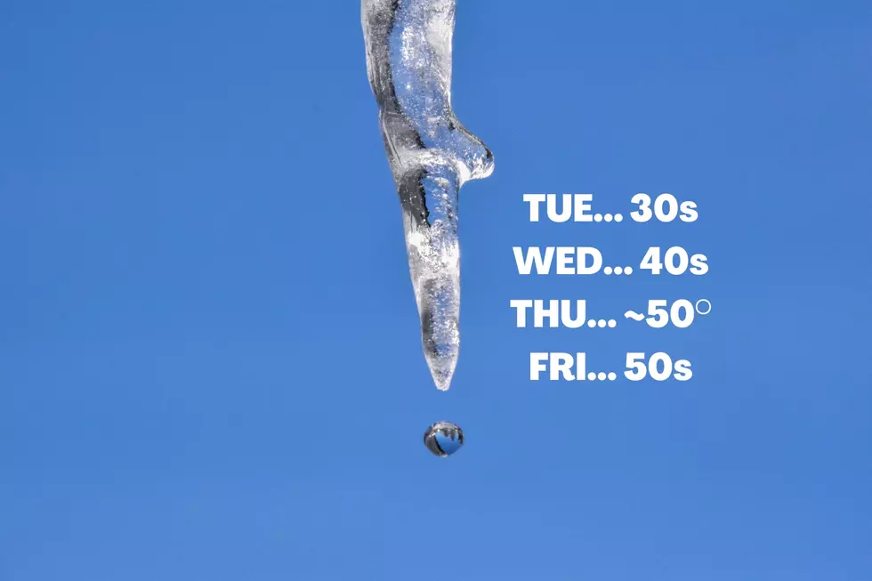
We will continue to dig out of our recent arctic blast Tuesday. High temperatures should reach the lower to mid 30s. For the first time since Friday, most of the state should push above the freezing mark.
Early clouds will give way to plenty of sunshine Tuesday afternoon. We will stay dry, with light winds.
For Tuesday night, again it will be cold, but not crazily so. Look for lows in the seasonable mid to upper 20s. No nasty wind chill or precipitation to deal with. Maybe some light patchy fog.
Wednesday
Getting noticeably warmer, as temperatures swing from below-normal to above-normal.
High temperatures on Wednesday will make a run for the mid 40s across the state. (With the exception of colder NW NJ.) I'll call it partly sunny, with a variety of fair weather clouds visiting throughout the day.
A couple models paint some flurries and/or sprinkles over North Jersey Wednesday morning. But our air mass is going to be very dry — so I've left the mention of snowflakes and raindrops completely out of my "official" forecast.
Thursday
50 degrees! Woohoo!
All signs point to a very nice day Thursday, with mostly sunny skies, a light southwesterly breeze, and high temps near 50.
Friday
The warmup really starts to peak as 2022 comes to an end. Look for highs in the lower to mid 50s on Friday. That's 10+ degrees above normal for late December. Clouds will increase, but the entire day looks dry.
New Year's Weekend & Beyond
Our next storm system will drive in this weekend, potentially adding some inclement weather to your New Year's Eve and/or New Year's Day festivities.
WIth temperatures still in the 50s — or even 60+ in South Jersey — we are talking about just raindrops. There could be a period of steadier rain, especially from late Saturday into early Sunday. Yes, that's just as we are ringing in 2023. No severe or crazy weather here — just wet.
The extended forecast keeps mild temperatures around through the first week of January.
Of course, this time of year, we are always scanning the horizon for possible snow. I don't think our next opportunity for wintry weather will develop until about a week after New Year's. (So more than 10 days from now.) That's when we could have an atmospheric pattern and cold-enough temperatures to sustain accumulating snow. As always, we will keep you posted.
Dan Zarrow is Chief Meteorologist for Townsquare Media New Jersey. Follow him on Facebook or Twitter for the latest forecast and realtime weather updates.
7 things NJ workers deserve for a better work-life balance
Gallery Credit: Mike Brant
The best store in New Jersey you've probably never been to
Gallery Credit: Dennis Malloy
More From Beach Radio