NJ weekend weather: Building humidity and warmth, a few storms
UPDATE as of 7:45 a.m. Saturday...
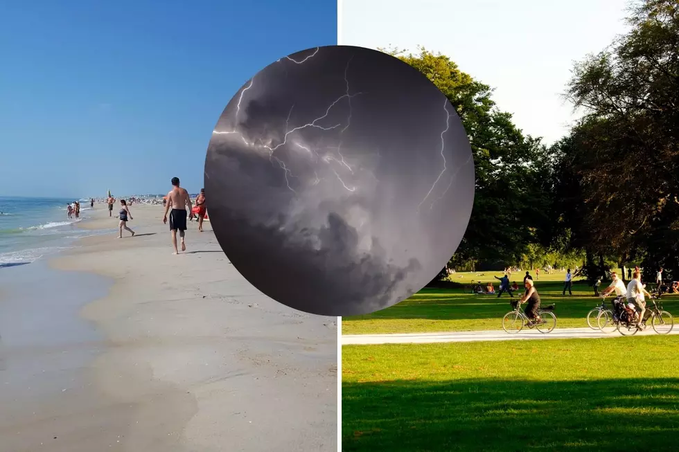
Good morning! Just wanted to leave some quick notes on how the weekend forecast is shaping up. In a nutshell: Warm, humid, and unsettled. But neither day will be even close to a washout.
Saturday will start fine. Partly sunny and humid, with highs in the 80s. A few showers and thunderstorms will sprout between about 3 p.m. and 1 a.m. The risk of severe weather is low, but there could be some localized downpours.
For Sunday, rain has trended later. The best chance of showers will be dinnertime or later.
Monday doesn't look great, with 2 or 3 rounds of rain anticipated. At least that will limit the severe thunderstorm potential.
Hot, hot, hot! 90s kick in Tuesday, and will last at least a week.
ORIGINAL POST from 6:41 a.m. Friday...
The Bottom Line
There is a chance of rain in the forecast over the next four days. (And, for the record, we really need it.)
However, along the way, you will find pockets of pleasant, warm, humid, rain-free weather too.
The long-range weather forecast is brought to you by the letter "H" — for hazy, hot, and humid weather. And by the number "95" — which could be our high temperature by the middle of next week.
I want to try something a little different in this blog post, and include a little outline at the top of each forecast day. Hopefully it helps you understand the "character" of each day's weather, so you can plan accordingly.

Friday
—Humidity... Low
—Thunderstorm Spread... Isolated
—Severe Weather Risk... Very Low
—Best Chance of Storms... Afternoon, along and south of I-195
A stationary front parked off New Jersey's southern coast is still pretty ... stationary. We had a few showers lick Cape May County in far southern NJ overnight. Those have since exited, although clouds may linger along the Jersey Shore for the first part of Friday.
It is going to be a mostly sunny and seasonably warm summer day. Best of all, humidity levels will be quite manageable and comfortable. (Considering our usual summertime soupy air.) Look for high temperatures in the mid 80s for most. Cooler 80-ish along the coast.
The only wrinkle Friday will be the reemergence of popup thunderstorms. They will be very isolated — the size of a town, and lasting all of about 15 minutes — but there could be a localized downpour or two. The shower chance will be limited to the afternoon and evening hours. And only in the southern half of the state, along and south of Interstate 195.
Beyond sunset, dry weather resumes overnight. We'll see increasing clouds and maybe some patchy fog. Low temps should dip into the seasonable upper 60s.
Saturday
—Humidity... Moderate to High
—Thunderstorm Spread... Spotty to Scattered
—Severe Weather Risk... Very Low
—Best Chance of Storms... Afternoon and evening
First of all, you will notice humidity ramp up Saturday, with a certain thickness or steaminess in the air. With scattered clouds overhead and a subtle on-shore component to the breeze, high temperatures will come down a bit to the lower-mid 80s.
Second, as a weak disturbance rides through New Jersey's atmosphere, a few showers and thunderstorms are likely to fire up.
Nailing down the geography and timing of those raindrops is tricky, as different forecast models have different ideas of how the day will play out. (That's not unusual for such a "hit or miss" rain event.) I'll take a stab and say peak storm activity will be between about 2 p.m. and Midnight. Again, it's not going to rain that entire time — it will be an "eyes on the sky" kind of situation.
Sunday
—Humidity... High
—Thunderstorm Spread... Spotty to Scattered
—Severe Weather Risk... Low to Moderate
—Best Chance of Storms... Midday through early evening
Sunday looks almost the same as Saturday. It will be slightly more humid, with dew points pushing into the 70s. It will be somewhat cloudier. And it will be warmer, with highs back in the mid 80s. (So maybe not so similar after all, haha.)
And once again, we face the chance for some hit-or-miss thunderstorms on Sunday. Model guidance has been really wishy-washy about where and when (and if) storms will pop on Sunday. So this is a pretty low confidence forecast. The chance for storms is enough that you'll want to keep your plans flexible. Especially since there could be a stronger storm cell at some point, given our hot and juicy atmosphere.
But again, Sunday is absolutely not going to be a widespread soaking.
Monday
—Humidity... High
—Thunderstorm Spread... Scattered to Widespread
—Severe Weather Risk... Moderate
—Best Chance of Storms... Late afternoon through early evening
Monday will probably present our best chance of thunderstorms, as a cold front approaches New Jersey.
For starters, Monday will be hot and humid, with high temperatures peaking near 90 degrees. We'll see a mix of sun and clouds during the morning and early afternoon hours.
A line of storms is forecast to encroach upon the western border of New Jersey around Monday late afternoon (starting after 3 or 4 p.m.) I'd wager those storms will be on the strong side, gusty and super-soakers. And then could be rather widespread, pushing across the entire state into the evening hours.
The Extended Forecast
Behind that (weak) cold front, Tuesday's temperatures and humidity levels will drop ever so slightly. But we'll still see highs near 90 degrees. It's the only completely dry day in the forecast for the next week.
Wednesday could be New Jersey's first taste of excessive / dangerous heat of the summer. With highs in the lower to mid 90s, accompanied by high humidity, the heat index (the "feels like" or "apparent" temperature) could come close to 100. Thursday too. Each day could spark some strong thunderstorms.
Long-range models still show a hot second half of July overall. Two or three weeks of high humidity and mainly 90s? Sounds like the "dog days of summer" to me.
Have a wonderful, safe, relaxing weekend!
Dan Zarrow is Chief Meteorologist for Townsquare Media New Jersey. Follow him on Facebook or Twitter for the latest forecast and realtime weather updates.
Cape May, NJ: 15 wonderful places to visit
Gallery Credit: Erin Vogt
15 sensational places to visit in Seaside Heights and Seaside Park
Gallery Credit: Erin Vogt
More From Beach Radio