
NJ weather: Weekend begins mainly dry, ends hot and humid
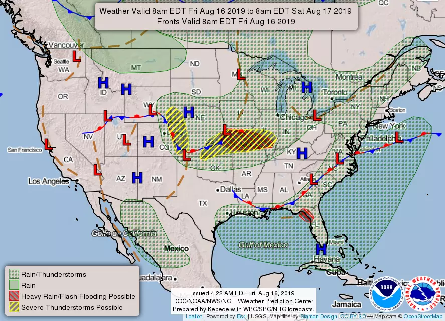
All week long, we've been watching a stalled frontal boundary south of New Jersey. It's a familiar setup, that's happened countless times over the past year. Such a stationary front leads to unsettled weather, as little storm systems ride along and constantly produce clouds and rain.
However, that front is actually sitting pretty far south of us. So I'm leaning hard toward a mainly dry forecast, for at least the first half of the weekend. Good news!
As you step out the front door on this Friday morning, fog will not be an issue for you this time around. Temperatures are almost comfortable, ranging from near 60 on the hilltops to the lower 70s down the shore.
For the first half of Friday, you'll catch peeks of sunshine. Then more cloud cloud arrives through the afternoon, as humidity levels continue to rise too. We'll see high temperatures around 80 degrees — similar to (or just below) Thursday's highs.
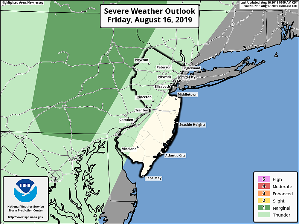
Models depict a few isolated showers or thunderstorms later on, mainly along the western edge of New Jersey. I wouldn't be surprised if areas along and west of the NJ Turnpike stay dry — but let's not completely rule out a stray shower or sprinkle at some point as those clouds thicken up.
For Friday night, skies will be mostly cloudy with lows around 70. I'm pretty confident some thick fog will develop between Midnight and daybreak Saturday morning.
Because of the position of that stationary front, I think Saturday will be a generally pleasant, warm summer day. Partly sunny skies and probably dry. It is going to get pretty steamy, with highs bumping into the seasonable mid 80s. The coast will end up a bit cooler, as usual.
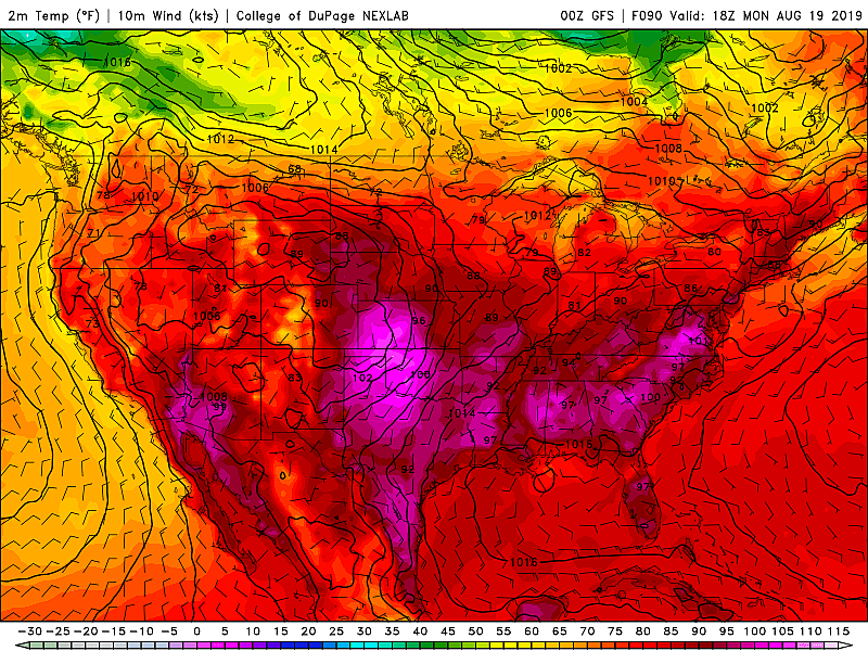
Sunday is looking mostly sunny, hot, and humid. Thermometers pop to around 90 degrees. And we have to talk about the heat index (or "feels like" temperature) again, which could reach the mid 90s — that's right on the edge of dangerous heat territory. Given the juicy air, a few late-day thunderstorms are expected on Sunday too.
And that's just the start of another potential heat wave, as Monday gets even hotter. High temps should reach the lower 90s (away from the coast), with a high index approaching 100 degrees. It looks like a sunny day, and I'm leaning toward a dry forecast for now.
The timing through the middle of next week is still a bit uncertain. But for now, I'm thinking Tuesday will remain ferociously hot, Wednesday will turn wet and stormy, and Thursday will bring a pattern change to drier, cooler, clearer weather.
Enjoy this weekend — only three more weekends before Labor Day!
More From Beach Radio