NJ weather: Next two storms systems will also be rainmakers
The Bottom Line
As promised, Thursday was an unpleasant, windy, and wet weather day, from start to finish. Top wind gusts reached 47 mph in a few spots. Top rainfall total was just over an inch, in Passaic County.
We'll catch two quiet — although unseasonably chilly — days now, before our next storm rolls in on Saturday. That one looks to play out very similarly to Wednesday's system, with about 8 hours of rain and wind.
Then we'll catch two quiet — although unseasonably chilly — days, before our next next storm rolls in on Tuesday. Again, rain and wind. Nothing big. Nothing wintry.
The long-range forecast gets a bit more interesting, as colder air and below-normal temperatures take over for the middle third of December.
Thursday
Happy 1st of December! This is the official start of climatological winter, the three coldest months of the year. And what do you know, December is New Jersey's third coldest month of the year on average, behind January and February. It is also our third snowiest (at least in the last 30 years). And the fourth wettest month of the year, which is pretty surprising.
It is also worth noting that the Atlantic Hurricane season officially came to an end on Wednesday. The season was active, with 14 named storms in the basin. The most significant was Ian, which maxed out at 155 mph winds and killed an estimated 157 people (mainly in Florida). You may recall the remnants of Ian parked off the NJ coast, dumping upwards of 8 inches over the Jersey Shore in early October.
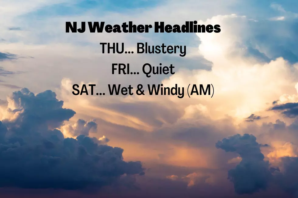
Anyway, following Wednesday's inclement weather, Thursday will be brighter and drier. But also cold and windy — we call that "blustery". Not my favorite combination.
Temperatures to start Thursday morning are in the 30s. But with a chilly breeze, the wind chill ("feels like" or "apparent" temperature) is mainly in the 20s. It's not a frigid January dead of winter kind of morning, but you will want to bundle up a little bit.
Highs Thursday afternoon will be limited to the lower 40s. Running 5 to 10 degrees below normal for early December. As the wind continues (possibly gusting to 30 mph), the wind chill will be stuck in the 30s at best.
Skies will be mostly sunny. The only clouds you'll see overhead are from fizzling lake effect snow showers over Pennsylvania and New York. A flurry is possible somewhere in New Jersey at some point.
The wind will finally calm down Thursday night, setting us up for a clear and cold night. Low temperatures will dip to around 30 degrees — a freeze for most of the state. (Inland areas, at least.)
Friday
Even though temperatures will still come up shy of seasonal normals, I think it's reasonable to call Friday a nice day.
Winds will stay light. Skies will be mostly sunny through at least late afternoon. And high temperatures will improve to the upper 40s.
Friday night won't be all that cold. In fact, thermometers may slowly rise through Saturday morning. Humidity will be on the rise too.
Saturday
Here comes our next storm system, an area of energy followed by a cold front. Rain showers will likely overspread New Jersey in the early morning hours — possibly before sunrise for some. A few more waves of light rain will continue through Saturday morning and midday. If all goes well, we'll dry out completely by early to mid afternoon — I'm confident it's not going to rain all day. Rainfall totals are forecast to reach about a quarter-inch to half-inch statewide.
Meanwhile, the low-level jet (river of strong winds about a mile overhead) looks weaker than Thursday, but more centered over New Jersey (rather than off-shore). The end result: Another chance of 40 mph wind gusts.
High temperatures on Saturday should come close to 60 degrees for all but far northern NJ.
Sunday
Back to the chilly side. Clouds, sun, a light breeze, and mid 40s. A dry and uneventful end to the weekend, at least.
The Extended Forecast
In terms of the weather, we can break next week into three segments.
To start, Monday will be similar to Friday. Mostly sunny, dry, and approaching 50.
Then, yet another rainmaker storm system will dampen the state on Tuesday. Again, nothing wintry, with temps in the 50s. There could be some elevated winds again, but damaging gusts seem unlikely.
The final part of next week will feature another cooldown. And forecast models suggest this could be a big one, bringing sustaining cold into New Jersey (and most of the United States) through the midpoint of December.
The big question for now: Will that cold air blast be "wasted," or could we see a significant pre-Winter Solstice snow event? We shall see!
Dan Zarrow is Chief Meteorologist for Townsquare Media New Jersey. Follow him on Facebook or Twitter for the latest forecast and realtime weather updates.
The 99 top paying jobs in New Jersey
30 unique 'experience' gifts New Jerseyans actually want to get
Gallery Credit: Dan Zarrow
More From Beach Radio