NJ weather: Gorgeous again Thursday, heat cranks up this weekend
The Bottom Line
Can we just declare this stretch as the nicest weather of the entire year? Wednesday was an amazing day, owing to sunshine, low humidity, and warm temperatures. For the most part, Thursday will be a repeat. And then our weather turns warmer and more unsettled heading into the weekend. The transition from springlike to summerlike is well-timed, as the Summer Solstice arrives Sunday night.

Thursday
Fair warning: It is unusually, even surprisingly cool out there on this Thursday morning. Most spots have fallen in the 50s. 40s are common across North Jersey and in the Pine Barrens. And even I'm shocked to see some 30s in NW NJ - in the middle of June! (Keep in mind, normal lows at this point of the year are in the lower 60s.)
It will be another gorgeous, sunny day with literally zero chance of rain. Look for highs mainly in the upper 70s to around 80 degrees across most of the state. If anything, Thursday will end up a degree or two cooler than Wednesday.
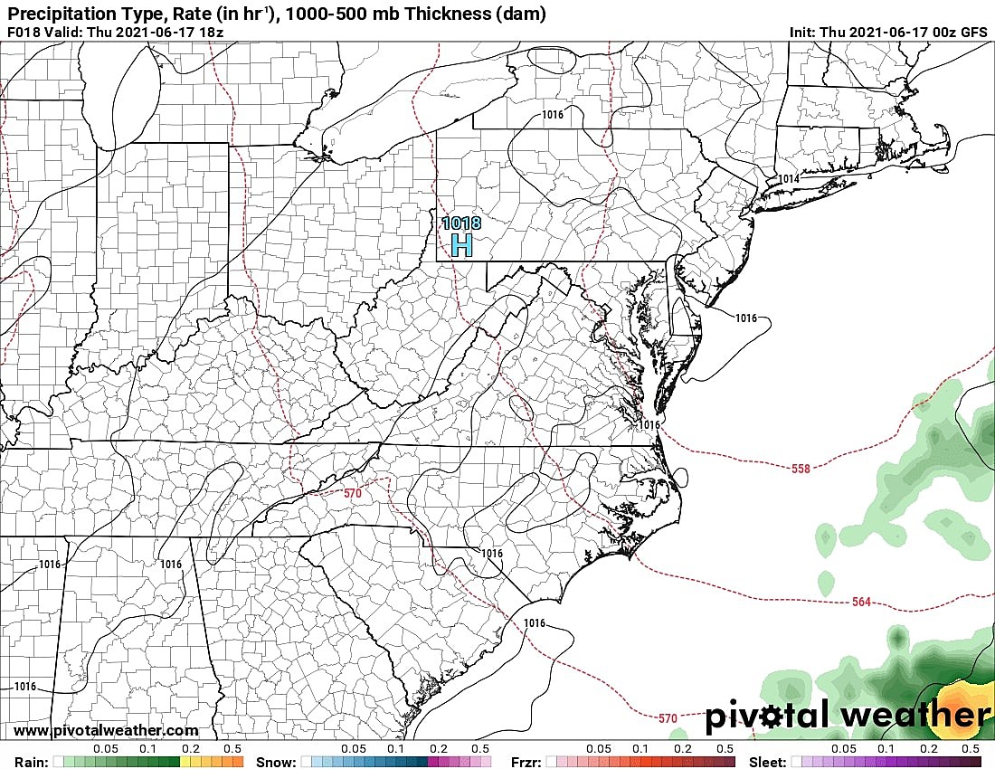
The biggest change will be a lighter ambient northwest breeze. That will allow the sea breeze machine to fire up, fueled by heating differences between the land area and the ocean. So while even barrier islands hit 80 degrees on Thursday, thermometers will be closer to 70 Wednesday afternoon.
Thursday night will stay quiet. I don't think it will be as chilly as the night before, with low temps averaging mid 50s. (A bit warmer for cities and coast, a bit cooler in the usual spots.)
Friday
As our protective dome of high pressure shifts away, we'll start to see some changes Friday. Clouds will start to increase from midday into the afternoon. Humidity will tick upward, but only slightly. (Dew points increase to about 60.) And a warming trend kicks in, with high temperatures pushing into the lower 80s.
Not bad at all. The only weather nuisance is a chance for some rain showers Friday evening. (The NAM continues to paint a wet picture from Friday afternoon into Friday night. But it stands alone in the track and moisture content of that impending shortwave.)
Humidity levels will really start to ramp up Friday night. We'll only fall into the 60s by Saturday morning, a noticeable difference from the past few overnights.
Saturday
Turning steamy and summerlike again. But again, that's not necessarily a terrible thing. Especially since I've been able to pull back the reins on rain chances.
We'll see a mix of sun and clouds throughout Saturday, with a stiff breeze out of the southwest gusting over 20 mph. High temperatures will push into the upper 80s or so. 90+ is certainly a possibility in urban areas and/or SW NJ. The coast will end up at least a few degrees cooler.
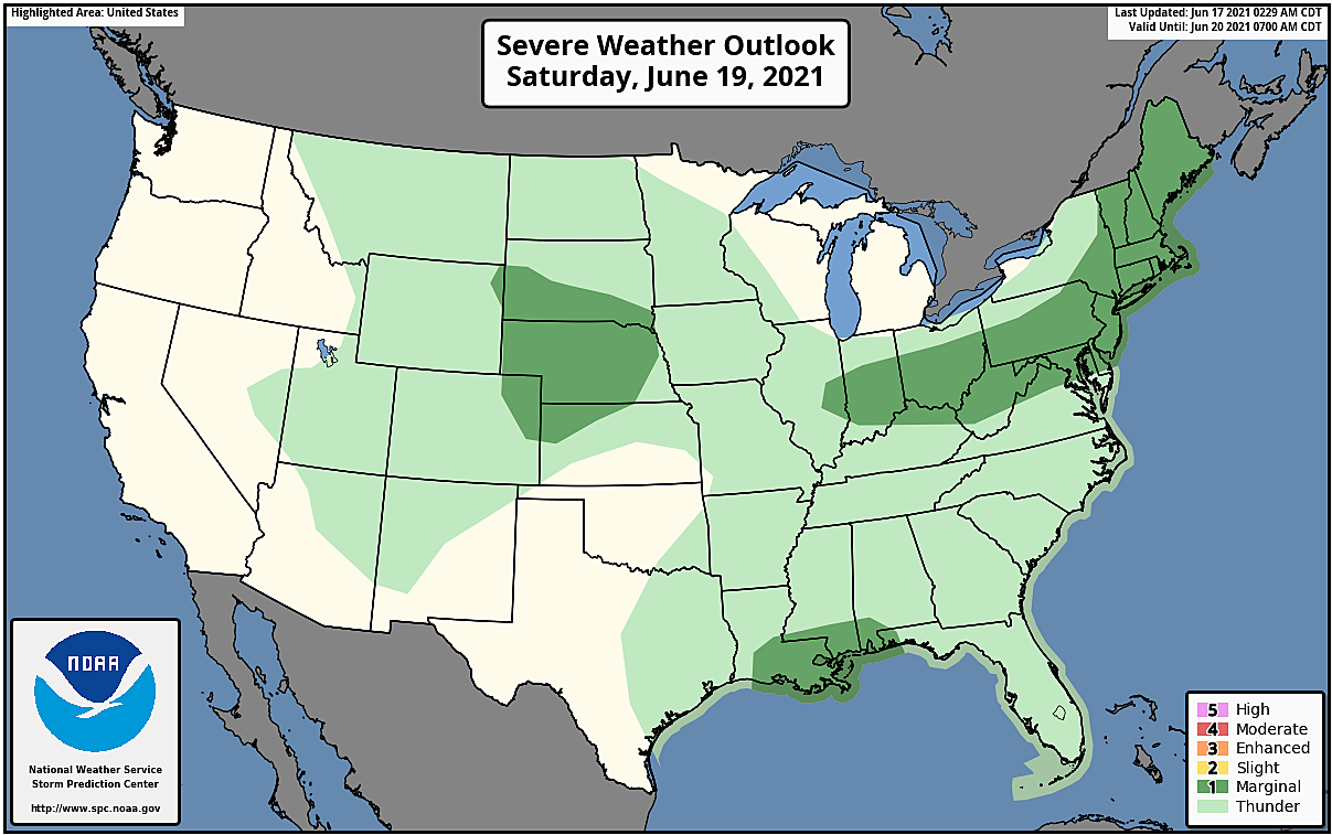
An approaching cold front is expected to fire off some spotty showers and thunderstorms Saturday afternoon into Saturday evening. However, that front is not looking all that impressive according to the latest model guidance. Therefore, I don't think rain and storms will be all that widespread. Given the heat and humidity, however, any storms that do form could produce some heavy rain and gusty winds. The Storm Prediction Center agrees - NJ falls under the level 1 "Marginal Risk" area for Saturday.
Sunday
The other impact of a weaker front? Only a minimal cooldown heading into Father's Day.
High temps will soar into the mid 80s or so on Sunday. Once again, I can't rule out a few 90s among the state's hot spots. While a couple of model solutions have hinted at an early morning or late evening shower, I've opted for a dry forecast for now. It will be partly sunny, warm, and slightly less humid. Seems like a great way to officially ring in Summer. (At 11:32 p.m. Sunday evening.)
The Extended Forecast
Our weather will likely stay summerlike and sultry early next week, with 80s (at least) for Monday. Clouds will probably win the sky, with a southerly breeze keeping humidity levels elevated.
Beyond Monday daytime, our weather forecast gets murky. We're still watching a developing storm system entering the Gulf of Mexico, which will likely become a tropical depression or tropical storm later Thursday. (The next name on the list is Claudette.)
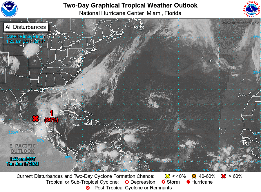
The track of such storms is very low confidence that far out, so we can't make a certain call on Gulf Coast landfall and eventual East Coast impacts just yet. Most model guidance keeps the storm south of NJ on Tuesday, but that's not a guarantee. We'll just have to sit and wait for now.
Dan Zarrow is Chief Meteorologist for Townsquare Media New Jersey. Follow him on Facebook or Twitter for the latest forecast and realtime weather updates.
These Beautiful New Jersey Sunsets Will Take Your Breath Away
More From Beach Radio