More yucky weather Tuesday – watching an end-of-week arctic blast
I really think "yucky" is the operative word for this Tuesday morning. There isn't a whole lot of activity on radar — just a few spotty batches of light rain. But no matter where in the state you are, you'll encounter drizzle and fog making for wet conditions and lower visibility.
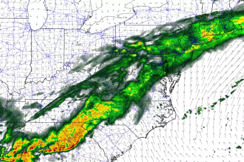
It looks like our latest storm system will deliver one more big push of rain from Tuesday late morning through Tuesday early afternoon. Additional rainfall could be as high as an inch. But once again, we're not worried about flooding or anything overly dramatic — just reduced visibility, slick roads, and general misery.
By Tuesday late afternoon, our rain should be done. I don't expect skies to clear much, but you might catch a peek of sunshine just before sunset Tuesday evening. High temperatures should end up on either side of 50 degrees — above-normal for mid-February.
Tuesday night's forecast is dry, somewhat breezy, and mostly cloudy. Most of the state will stay above freezing, with low temps generally in the mid 30s.
And most of Wednesday daytime will be fine. We'll still have lots of cloud cover, and temperatures will be slightly cooler. But highs in the mid to upper 40s are still above seasonal norms.
Our next storm system moves in late Wednesday. First raindrops may creep into the Garden State as early as about 4 p.m., with rainfall picking up through Wednesday evening. We had been watching a chance for some wintry weather in North Jersey during this time frame. But models have trended just a bit warmer. So I'm still including some snowflakes in Wednesday night's forecast (north of I-80), but any kind of significant accumulation seems unlikely now.
Rain will continue through at least the first half of Thursday. Then, as we dry out and skies begin to clear, a big transition will arrive.
High temperatures on Thursday will be toasty warm, ranging from the mid 40s (far north) to the mid 50s (central) to the lower 60s (south). However, a cold front will open the door to the arctic — something that has not happened much this winter season so far. The difference in temperatures will be quite noticeable. And downright bitter.
A west-northwest wind (sustained 15-25 mph, gusts to 40 mph) will carry in that colder air starting Thursday afternoon. Temperatures will steadily decline Thursday night, likely ending up in the chilly 20s. Wind chills (the "feels like" or "apparent" temperature) will likely hover in the teens.
And that's about where we'll stay on Friday. It will be sunny and breezy, with afternoon high temperatures ranging from the mid 20s (north) and lower 30s (south). Most of New Jersey will begin a stretch of 36 to 48 hours of below-freezing temperatures. Again, not totally unusually for wintertime here in New Jersey — but this particular winter hasn't really featured this degree of frigidity.
The core of this cold air mass will be on top of us Saturday morning. Low temps may dip into the single digits. (Brrr!) Wind chills could fall below zero. (Double Brrr!) That's approaching "dangerous cold" territory, so make sure you're dressing in layers with heavy coat, hat, and gloves.
Saturday's high temperature will once again get stuck in the mid 20s to lower 30s. And once again, it will be a bright, sunny, dry winter day.
As winds become south-southwesterly on Sunday, we'll experience two important weather changes: 1.) Increased cloud cover, and 2.) increased temperatures. That's right, thermometers will recover nicely for the second half of the weekend. Current guidance suggests mid to upper 40s for most, again bumping above normal.
The mild temps and quiet weather will continue into Monday. Then our next storm system — another rainmaker — is scheduled to arrive next Tuesday.
Lots of twists and turns in this forecast, but still no substantial snow to speak of! Enjoy the warmth, enjoy the chill, and enjoy the rain!
More From Beach Radio


