In NJ’s forecast: a near-miss, an arctic blast, maybe a big storm
The Bottom Line
While Wednesday’s weather looks quiet and relatively pleasant, there sure is a lot to talk about in the forecast between now and the end of January.
A storm system will pass south and east of New Jersey, and will spit nothing more than clouds and a snow showers our way.
Then the door to the arctic opens, leading to some bitterly (even dangerously) cold conditions.
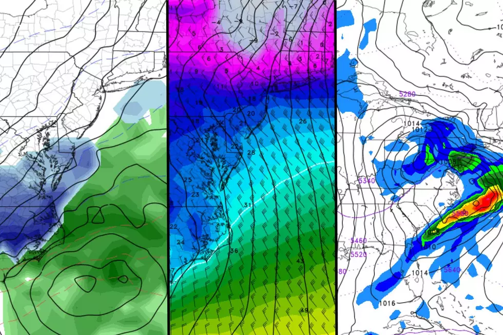
Finally, we’re watching a powerful yet complicated storm system at the tail-end of the weekend, which could be our next chance of snow (and/or rain).

Wednesday
It’s going to be the nicest and the warmest day of the next week (at least), so enjoy!
Having said that, we’re experiencing “last licks” of Tuesday’s minor storm system on this Wednesday morning. There are some tiny pockets of flurries and sprinkles in northern New Jersey. And possibly some slippery spots north of Interstate 78, where our weather has been pretty wintry. (Top snow total: 1.2 inches in Sussex County.)
Meanwhile, most of the state is blanketed in fog, with visibility as low as a quarter-mile in spots. That should lift by around 9 a.m.
Skies will become partly sunny, with quiet weather and a light breeze. High temperatures should reach about 40 degrees, close to normal for late January.
Wednesday night will stay seasonably cold and dry, with some clouds overhead. Lows will dip into the mid 20s.
Thursday
A storm system is just tracking too far south for New Jersey to face another taste of wintry weather. While parts of North Carolina and Virginia will pick up 6+ inches of snow, we’ll be limited to a snow shower brushing by the coast. (And even that is a slight chance.)
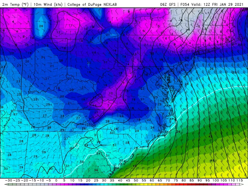
More importantly, we face another intrusion of cold arctic air. And oh, I do mean cold.
As morning clouds give way to afternoon sun, northwesterly wind gusts will push to 30 mph. Temperatures will start to tumble, with highs only in the lower to mid 30s — a full 5 to 10 degrees cooler than Wednesday.
Friday
The bottom of the barrel. A bitterly frigid day.
Morning low temperatures will bottom out in the teens. (Single digits in North Jersey.). With a continuing brisk wind (gusting to 20 mph), the wind chill (“feels like” temperature) could drop below zero. That is “dangerous cold” territory, meaning the combination of extreme cold and wind cause the human body to lose heat very quickly. That dramatically raises the risk of frostbite and hypothermia, if you don’t bundle up and limit exposure to the cold.
Afternoon highs will only reach the mid 20s. The wind will continue too, gusting to 35 mph during the day Friday. That means the wind chill will hover around 10 degrees in the afternoon.
The last time NJ was this cold? February 1, 2019.
Skies will be bright and sunny. Although I wouldn’t rule out a couple of snow showers or squalls at some point.
Saturday
Better. Sunny. Lighter winds. Highs in the lower to mid 30s. At least temperatures will pop above-freezing for all but North Jersey.
Sunday & Beyond
Our final weather headline comes at the end of the weekend, with another storm system modeled to impact New Jersey. This one looks potentially impactful and pretty powerful, with a track resembling a “Miller Type B” nor’easter. (That’s when an inland low transfers its energy to an intense coastal low, producing heavy precipitation and northeasterly winds across the East Coast.)
But the phasing and track have to be perfect to be a big snowmaker for New Jersey.
With almost 5 days to go until first flakes/drops, model guidance is still painting a variety of solutions for this storm. So uncertainty is still too high to officially call this a “hit” or a “miss”, offer a definitive timeline, or start talking confidently about totals.
Everything from 12+ inches of snow to 2+ inches of rain is on the table. (And frankly, we could see both of those scenarios play out at opposite ends of New Jersey!).
The storm timeline could include late Sunday, all-day Monday, all-day Tuesday, and early Wednesday.
I hope that within the next 24 to 36 hours (i.e. sometime Thursday), we’ll have a better sense of whether or not this storm will impact New Jersey. (I’m certainly leaning in that direction.). We’ll probably start piecing together some storm scenarios at that point too. Stay tuned!
Dan Zarrow is Chief Meteorologist for Townsquare Media New Jersey. Follow him on Facebook or Twitter for the latest forecast and realtime weather updates.
The 10 Best Sunrises in Seaside Park
More From Beach Radio