A snowy Tuesday for North Jersey – next storm system aiming South
The Bottom Line
A very active weather pattern continues. We're still tracking three storm systems this week — one primarily for North Jersey on Tuesday, one mainly in South Jersey on Thursday, and a potential nor'easter around Sunday. Temperatures will range from cold to really cold. And it's looking like this stormy weather pattern will hold through next week too.

Tuesday
Storm system #1. Mainly a North Jersey concern.
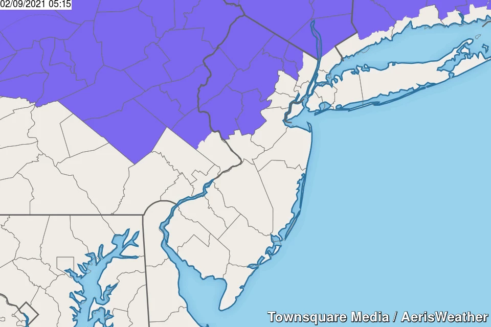
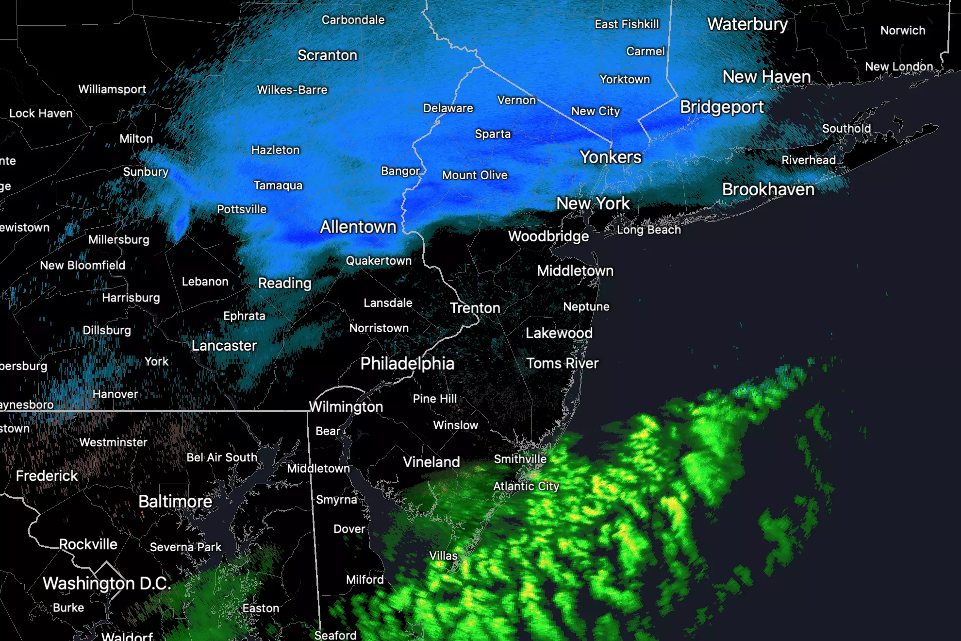
As of this writing (5:30 a.m.), a band of snow has enveloped the northern third of the state. The southern edge of that snow band is almost exactly lined up along Interstate 78 through Hunterdon, Somerset, Union, Essex, and Hudson counties. We have also seen some spotty rain showers (yes, just plain rain) along the southern coast.
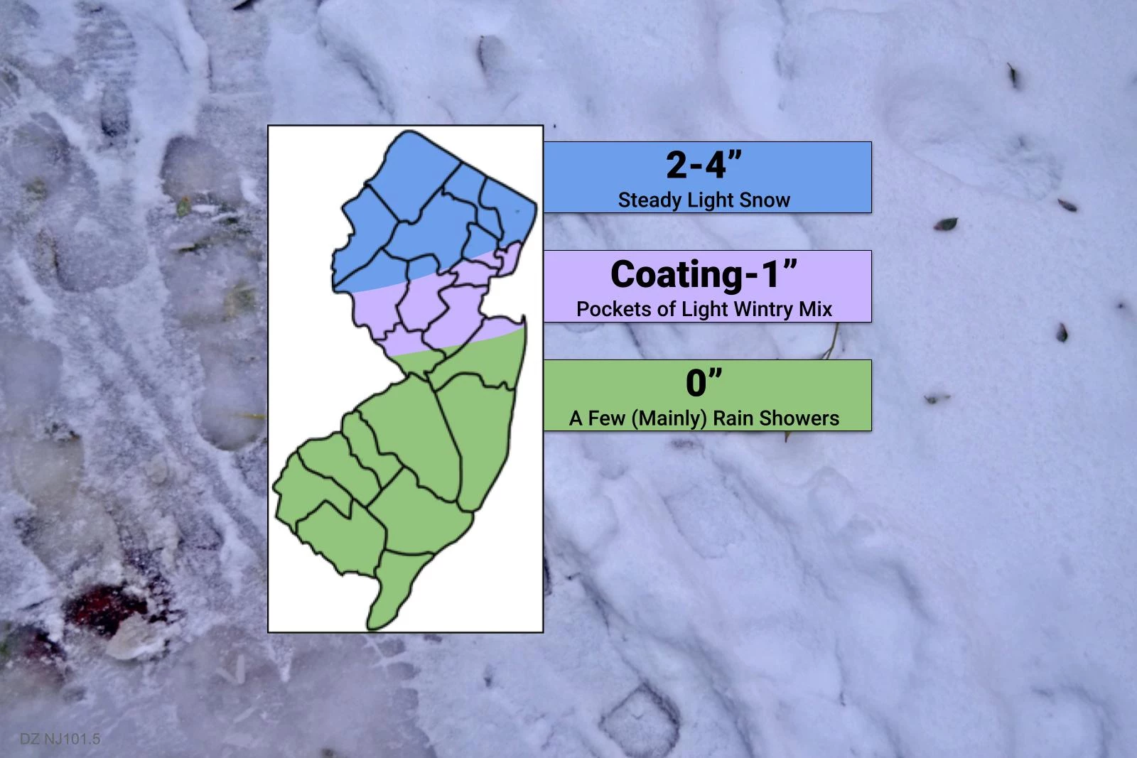
I only made some tweaks in my final snowfall forecast here, adjusting my blue "snow zone" area based on initial snow band location. And I shrunk the coating/mix area a bit too. Overall impacts are similar to what I promoted on Monday, and confidence is pretty solid.
Steady light snow is probably going to continue in North Jersey for another 8 to 10 hours, through about mid-afternoon. It will be all snow, and is already starting to stick to the ground. Accumulations of 2 to 4 inches seem like a good bet in the "snow zone". We pop from "minor" to "moderate" impacts once totals reach 3+ inches. So there will be some traffic snarls and travel headaches Tuesday. The new snowfall will be shovelable, and possibly plowable. It will be dry and fluffy snow (not heavy and wet).
A Winter Weather Advisory is in effect for 7 counties in northern New Jersey through Tuesday afternoon: western Bergen, Hunterdon, Morris, Passaic, Somerset, Sussex, and Warren.
Farther south, there remains much uncertainty about what happens around northern Mercer, northern Monmouth, Hunterdon, Somerset, Middlesex, and Union counties. Some snow, some wintry mix, and some rain perhaps? There is a chance for a healthy coating of snow accumulation. And even more concerning, a light glaze of ice is possible since the ground is so cold (and partially snow-covered).
For the southern half of the state (and then some), this won't be a "winter storm" for you. Just a few showers, mainly rain, with some snowflakes possibly mixed in. (Temperatures across South Jersey are expected to soar into the 40s today!)
I expect wet and/or wintry weather to largely taper off through about 4 p.m. Tuesday. Then, Tuesday night will be mostly cloudy and seasonably cold, with lows in the lower to mid 20s. (Some teens in NW NJ.)
Wednesday
We'll squeeze out a quiet, partly sunny day. High temperatures will reach the mid 30s. Above freezing, but slightly below normal.
Thursday
Storm system #2. Mainly (but not exclusively) a South Jersey thing.
This one will play out in two parts. The first wave will pass just south of New Jersey between about 2 a.m. and Noon Thursday. It's looking rather sickly — weak and compact — on the latest model runs. So snowfall from this first round looks to be limited to far southern New Jersey only. (I did include a snow shower chance in my forecast up to I-195 too, just in case.)
Following a short lull, round two will kick in from about 5 p.m. Thursday through 9 a.m. Friday. The spread and strength of this piece of energy looks a bit broader. So I think snowfall will be more widespread, firmly reaching across the southern half to third of the state.
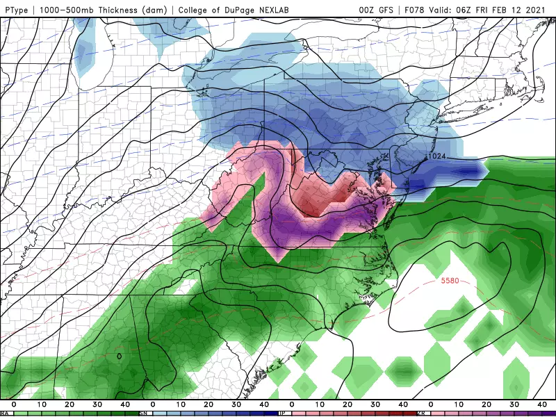
Since we'll be on the cold side of both impulses, there's no doubt in my mind that this will be a snowmaker.
Each round could produce snowfall accumulation on the order of 1 to 3 inches. That means for South Jersey, which looks snowy both in the morning and evening, we could see up to 6 inches of snow. Depending on how widespread the evening snow becomes, I'll even say an inch or two of accumulation is possible into North Jersey too.
I'm not 100% convinced that geography is locked in — with 36 to 48 hours to go until first flakes, the storm still has some wiggling to do. I'm going to hold off on making a snow map until either Tuesday afternoon or Wednesday morning, to get a more certain and more confident view of where each round's snow band will likely set up. I also don't want another snow map to muddy the forecast for Tuesday's snowfall — one of many reasons I prefer to handle one storm at a time.
Friday
Any residual snow will wrap up by mid-morning. And then we'll catch breaks of sun. High temperatures will only reach about 30 degrees — most of the state will stay below freezing all day.
The Weekend
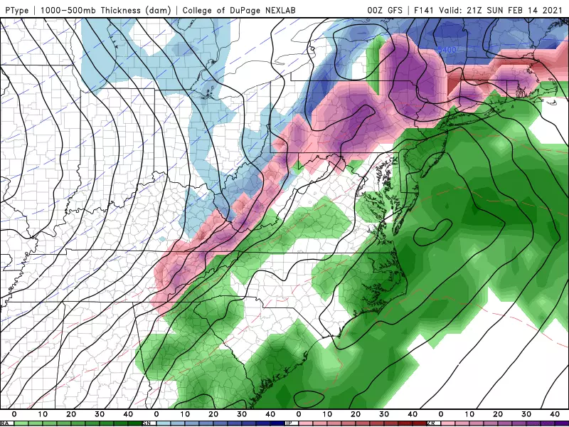
Storm system #3. A potential nor'easter. But this is a highly uncertain forecast, with scenarios ranging from snowy to rainy to nothing.
Medium-range models are favoring a coastal storm — a nor'easter — in the Saturday night to Sunday time frame. However, there's a wide range of scenarios on the table for New Jersey. Ranging from very snowy to snowy to rainy to absolutely nothing. Depending on the strength and track of the storm system, wind and coastal flooding could be threats too.
So this one remains in the "worth watching" category for now. If appropriate, we'll start filling in details around Friday.
The Extended Forecast
It is ridiculously cold just to our northwest, as a result of the polar vortex breaking down and spitting arctic air toward the northern U.S. (Chicago's low temperature Tuesday morning is approximately 0 degrees.)
It looks like the core of that cold air will spread our way next week. Yes, that means it's only going to get colder, before we have any chance of a warmup.
It also means any subsequent storm system traveling around the edge of that cold air mass could lead to additional snow.
Bottom line: Don't expect a change in our active, cold weather pattern for at least the next 7 to 10 days! #BundleUp
Dan Zarrow is Chief Meteorologist for Townsquare Media New Jersey. Follow him on Facebook or Twitter for the latest forecast and realtime weather updates.
50 Famous Brands That No Longer Exist
More From Beach Radio