A big warmup is coming soon, NJ – stormy weather too
The Bottom Line
One more day of unseasonably cold temperatures. One more day of bundling up like it's the middle of winter.
Thursday will end up 20+ degrees warmer than Wednesday.
But the warmup will come with unsettled weather: clouds, wind, showers, and thunderstorms. And some of those storms Thursday evening could contain gusty winds.
Then we cool down again to start the month of April. However, this one is not an "arctic blast" - more like a "correction to normal" as we begin a stretch of seasonable, typical early spring weather.
Wednesday
For the second morning in a row, the weather station at Atlantic City International Airport (in Egg Harbor Township) scored a record low. Morning temperatures are mainly in the teens and 20s. The coast is a bit warmer, barely above the freezing mark. Once again, you'll want to bundle up as you would in the middle of winter.
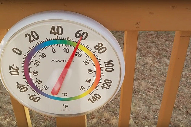
Having said that, it will be a more comfortable day. First, temperatures will push into the mid to upper 40s — on the order of 5 degrees warmer than Tuesday. And the wind will be much lighter and less biting, so we won't have that "blustery" characteristic to the day.
In general, we'll have periods of sun and clouds throughout the day.
The one little hiccup in Wednesday's forecast is a weak impulse that will try to push across the state from west to east in the midday hours. I have included the chance of light wintry mix showers in the forecast, mainly to the north. But those raindrops and snowflakes will be battling a very dry atmosphere, so the precipitation should fizzle significantly. Don't expect much here.
Wednesday night will feature increasing clouds and increasing temperatures. For at least the southern half of the state, we'll probably see thermometers rise from the 40s into the 50s by daybreak Thursday morning. For the record, that is already warmer than every single hour of the past four days.
Spotty rain may develop along the warm front overnight too.
Thursday
Mostly cloudy, breezy, and warm. High temperatures will push to about 65 to 70 degrees — firmly above normal for the final day of March.
Thursday will also be an unsettled day — everyone in the state will get wet at some point.
A few waves of rain will impact New Jersey on Thursday. As I mentioned, spotty showers will be possible in the early morning hours. And then scattered rain showers may develop during the daytime hours.
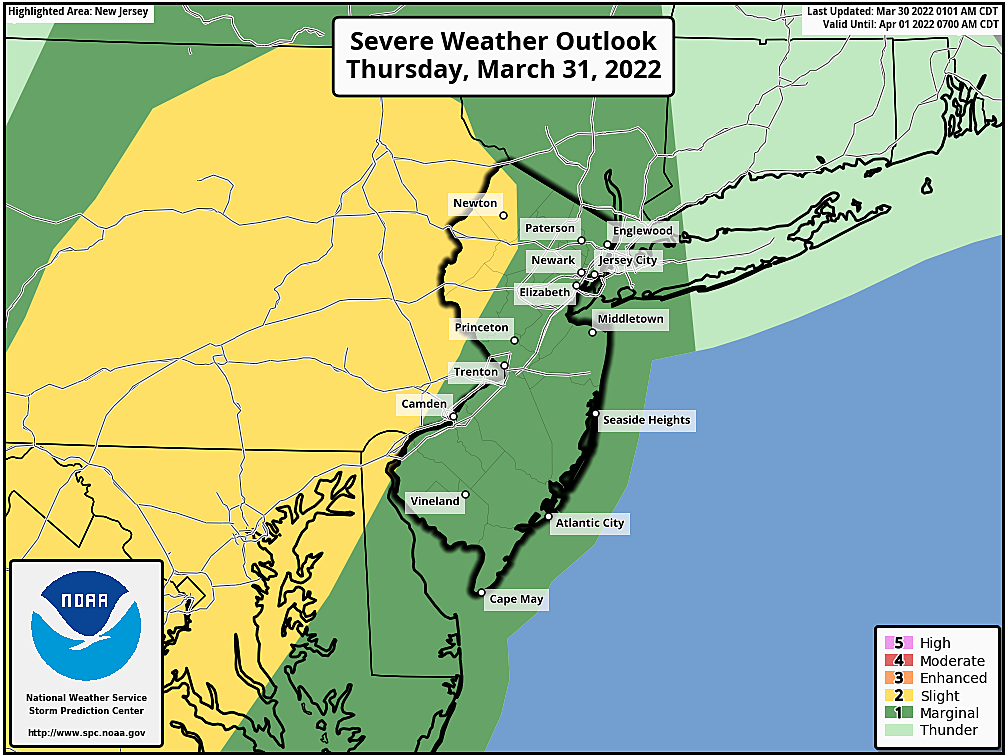
The big concern is what happens Thursday evening, with a grand finale round of thunderstorms. Gusty winds and localized downpours would be the primary hazards, although the risk of some hail and even a tornado aren't zero. (As we've advertised for several days, the best chance for severe weather would be along the western edge of the state.)
The ingredients are there. But will we get storms find their spark? And how intense will they get? Honestly, I'm still not impressed. The factors we'll have to watch are:
1.) Instability. The more sunshine we see on Thursday, the more the atmosphere will "cook," and the more potential energy will be available for strong storms in the evening.
2.) Timing. Latest model guidance pushes peak thunderstorm time later — closer to Midnight than dinnertime. After sunset, it becomes more difficult for thunderstorms to maintain their intensity.
Friday
Eventually, a cold front will push through New Jersey Friday morning. Putting an end to any threat of showers and storms. And putting an end to our warmup.
Friday's big weather nuisance will be a brisk wind, blowing out of the west up to 35 mph. Otherwise, we'll do OK for the 1st of April, with partly sunny skies and temperatures in the upper 50s. (Those temps may start to slide backward by late afternoon as cooler air arrives.)
The Weekend & Beyond
By Saturday morning, non-coastal New Jersey will be back in frost-freeze territory with low temperatures in the 30s. Then it will be a pleasant, seasonable spring day with plenty of sunshine and highs in the mid 50s.
Temperatures will stay pretty consistent through next week too. I have mid to upper 50s in the forecast for Sunday, Monday, and Tuesday.
A brief rain shower may develop on Sunday, but it should not be an all-day, all-state soaking.
Our next significant storm system is set to arrive in the middle of next week, in the Tuesday-Wednesday-Thursday time frame. At the moment, it looks like a rainmaker — good news, since we could definitely use another good soaking. However, it's worth noting that we're still at a point in the season where snow is absolutely possible. So we'll see how that storm complex continues to develop.
Dan Zarrow is Chief Meteorologist for Townsquare Media New Jersey. Follow him on Facebook or Twitter for the latest forecast and realtime weather updates.
Cape May, NJ: 15 wonderful places to visit
Gallery Credit: Erin Vogt
15 sensational places to visit in Seaside Heights and Seaside Park
Gallery Credit: Erin Vogt
More From Beach Radio