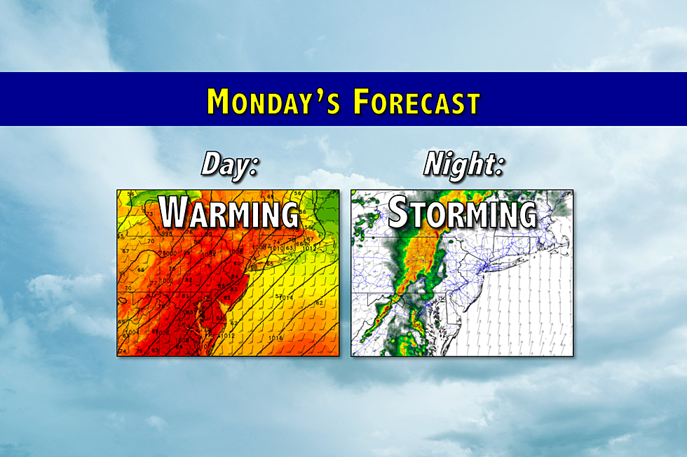
Warm and humid Monday for NJ, leading to a stormy night
While it won't be a terrible start to the new workweek and the month of May, the Garden State's weather will take a stormy turn Monday night.
Here are your weather headlines for Monday, May 1, 2017...
Warm, Breezy, Humid
Quite a wide variety of weather over the weekend, eh? A round of very loud thunderstorms on Friday night. A downright hot Saturday, as New Jersey recorded the first 90s of the season. And then a cooler, but fairly comfortable Sunday.
Thermometers will bounce back to the warm side on Monday, with forecast high temperatures reaching the upper 70s to lower 80s. We're starting the day with a warm front lifting into New Jersey, which has sparked some fog and drizzle across the state. (The fog is thickest in South Jersey and along the coast.) As fog burns off by late-morning, we should see breaks of sunshine. It's going to become quite breezy too, with gusts to 30 mph possible. That strong ambient wind will keep any sea breeze at bay, so even the coast will be warm. It might get a bit humid and sticky by Monday afternoon.
A Stormy Night
A strong cold front is forecast to pass across New Jersey Monday night. And along with the front will come a line of strong to severe thunderstorms.
It's going to be very important to stay smart, safe, and aware before and during these storms. Here's what you need to know:
--Timing: Monday daytime should remain dry, as models suggest the first raindrops will fall in northwestern NJ around 8 p.m. The strongest storms will pass across the state from Monday late evening through Tuesday early morning. Lingering showers will be possible through about 8 a.m. Tuesday.
--Impacts: The biggest concerns, as usual, will be torrential rain and strong winds. Lightning is always a thunderstorm danger too. There is also a marginal risk of a tornado (a 2 to 5 percent chance, according to the Storm Prediction Center) and hail.
--Bad News: The warmer (hotter) it gets Monday during the day, the more energy our atmosphere will have. More energy potentially lends toward stronger, more organized storms. (See SPC risk graphic above.)
--Good News: The timing of this system is our friend. As the atmosphere cools down in the evening, it loses a lot of energy from daytime heating. Therefore, it looks like the worst storms will occur west of New Jersey, before sunset and topography tear them apart. Hopefully, this means any storms lose some of their "oomph" as they charge across New Jersey.
The best place to be tonight is inside a sturdy building. Stay alert to any watches and warnings that may be issued.
Turning Cooler
Residual showers will wrap-up Tuesday morning. And, in the wake of the cold front, we'll see drier conditions and clearing skies through the afternoon. We should hold on to mild temperatures for one more day, with highs in the lower 70s. It will be windy Tuesday too.
The cooldown begins on Wednesday, as high temperatures will be limited to the mid 60s at the warmest. That's a bit below normal for early May (normal highs are in the upper 60s). Still a decent day, with a mix of sun and clouds alongside a stiff northwesterly breeze.
Thursday looks to be the coolest day of the week, as thermometers struggle to reach the upper 50s to lower 60s. Clouds will be on the increase on Thursday.
Another Rain Chance
Our next storm system of significance is scheduled for Friday, with steady to heavy rain expected throughout the day. (Possible "washout" alert.) The heaviest rain is currently modeled to push through the Garden State between 5 a.m. and 1 p.m. Friday. Rainfall totals over an inch are a pretty sure bet. It looks windy too.
More From Beach Radio


