One year ago: Isaias, NJ’s powerful, hard-to-pronounce tropical storm
There are certain storms in recent NJ history that are remembered for specific reasons. Floyd (1999) for inland flooding. Irene (2011) for heavy rain and flooding. Sandy (2012) for incredible storm surge and wind damage.
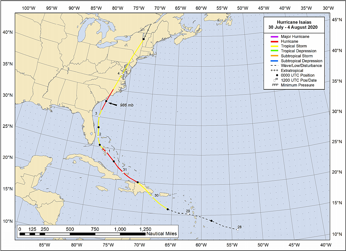
And then there's Isaias. As it tracked directly over New Jersey as a tropical stormon August 4, 2020 - exactly one year ago - parts of the Garden State were battered by intense wind, tropical rainfall, and tornadoes.
But perhaps the biggest memory we have of Isaias? How difficult it was to pronounce and spell it. (Repeat after me: ees-ah-EE-ahs)
Of course, Isaias was a powerhouse storm too. Over 1.3 million New Jerseyans lost power during the storm. And for some, it took almost a week before infrastructure was repaired and electricity restored.
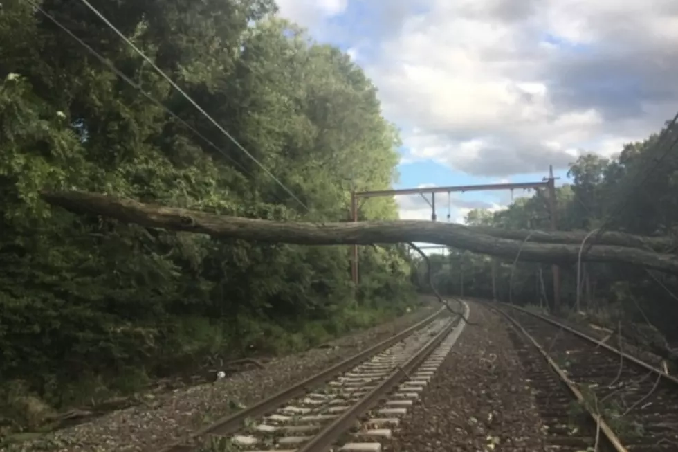
Wind gusts across New Jersey ranged from 30+ mph to the northwest, to 70+ mph along the southern coast. The iconic image of the storm's aftermath was the damage inflicted on a temporary tent housing Surflight Theatre in Beach Haven, LBI, Ocean County.
NJ's top measured wind gust during Isaias actually came from a weather station attached to a channel marker in the middle of Manahawkin Bay, just south of the Route 72 causeway. As a tornado passed directly overhead, a gust of 109 mph was recorded there. That tornado was rated EF-1 on the Enhanced Fujita scale, despite doing very little damage along its path.
Another earlier tornado moved on-shore in Upper Township, Cape May County, damaging numerous buildings, vehicles, trees, and wires.
There were several instances of heavy rain and flash flooding around the state. A pocket of 7+ inches of rain drenched part of Salem County in SW NJ.
Sadly, two deaths in New Jersey were attributed to Isaias' wrath. One man drowned off Cape May, New Jersey due to rip currents and rough surf. And in River Vale, Bergen County, another man doing storm cleanup was apparently electrocuted by a downed power line.
So Isaias was quite a storm. And it came less than a month after Tropical Storm Fay also soaked New Jersey with multiple inches of rain.
In fact, Isaias was such a big event here that I ranked it #2 on my countdown of the top weather stories of 2020. It was only bested by July 2020 ending up as New Jersey's hottest month ever recorded.
New Jersey's single worst weather day of 2020 was August 4th, as Tropical Storm Isaias (formerly a hurricane) passed directly overhead. (We'll never forget the correct pronunciation: ees-ah-EE-ahs.) More than 1.3 million power outages were reported across NJ, as 60-70+ mph wind gusts battered the Jersey Shore. A small pocket of southwestern New Jersey picked up over 7 inches of rain. And Isaias spawned two tornadoes here, near Strathmere (Cape May Co.) and near Brant Beach (Ocean Co.)
I was surprised that, at the annual meeting of the World Meteorological Organization's Hurricane Committee, Isaias was not chosen for retirement from the list of Atlantic hurricane names. Only Dorian, Laura, Eta, and Iota were deemed strong and significant enough to be replaced when the list recurs in 2026.
Yes, that means we could see another tropical storm or hurricane named Isaias down the road. I'll be practicing my pronunciation.
Dan Zarrow is Chief Meteorologist for Townsquare Media New Jersey. Follow him on Facebook or Twitter for the latest forecast and realtime weather updates.
Damage from Isaias in New Jersey
DAN ZARROW: NJ's Top 10 Weather Stories of 2020
More From Beach Radio