Monmouth, Morris, Middlesex center of final redistricting hearing
TRENTON – Monday’s release of draft redistricting maps sparked enough interest in a Wednesday hearing that an overflow session will be needed Friday, with Apportionment Commission members getting a final earful about the changes they should make or avoid in drawing a final map.
Over the span of three hours, commissioners heard plenty of additional pitches for the Fair Districts NJ coalition’s ‘unity map’ submitted last week, as well as specific pleas about how to treat places like Jersey City, Pennsauken, Hillside and broader regions of Middlesex, Monmouth and Morris counties.
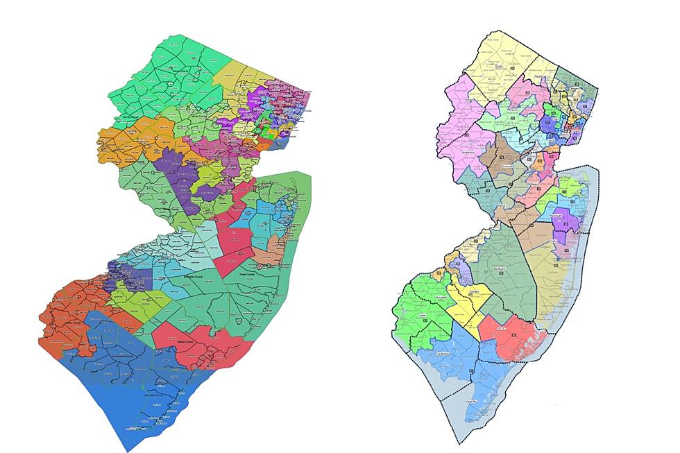
Two draft maps were made public Monday – one labeled Turnpike, which was drawn by the commission’s Democrats, and another dubbed Parkway, submitted by the Republicans. Both will be altered in negotiations before a final map is selected by March 1.
Morris County Republican chairwoman Laura Ali said the Democrats’ plan goes out of its way to redistrict Republican incumbents into facing off in primaries because they can’t beat them otherwise.
“The Turnpike map is a potential disaster in Morris County,” Ali said. “It’s breaking us up into six potential districts, which is ridiculous.”
Montville resident Karen Arakelian said that in tearing up the 26th District, the Turnpike map splits the Asian-Indian populations in Parsippany-Troy Hills, where 40% of residents are Asian, and Morris Plains, where 9% are.
“If the Parkway map had this division on it, the Republicans would be called racist,” Arakelian said.
Morris currently

Morris on Democratic draft map

Morris on Republican draft map

Khalid Anjum, who is the Democratic chairman in South Brunswick, said his hometown should stay in the 16th District – objecting to maps from the Republicans and the Fair Districts NJ coalition that move it into ones with Edison or other towns, in part to create the state’s first Asian-plurality legislative district.
“It would ultimately pack voters together and dilute the community’s ability for greater opportunities for representation at the state level,” Anjum said.
Matt Duffy, special counsel for redistricting for the New Jersey Institute for Social Justice, said splitting communities of interest or minority populations should be avoided if possible.
“It is not good,” Duffy said. It is one of the fundamentally understood precepts of redistricting that putting these communities together maximizes their ability to select representatives of their choice.”
The 16th District elected its first Asian-Indian woman lawmaker last year, Assemblywoman Sadaf Jaffer of Montgomery. The new senator from the district, Andrew Zwicker, is from South Brunswick. Democrats hold all three seats.
The Democratic map keeps much of the district’s core but makes such changes, such as adding West Windsor and Raritan Borough and removing Delaware, Flemington, Raritan Township and Stockton.
The Republican map puts it into a new 17th District with Franklin, Montgomery, North Brunswick, Plainsboro, Rocky Hill and West Windsor. The Fair Districts’ plan merges it with East Brunswick, Edison, Highland Park and Metuchen. In both, the Asian population would be a plurality of the residents.
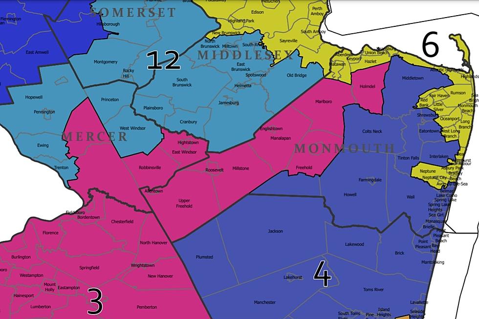
Middlesex currently

Middlesex on Republican draft map
Middlesex on Fair Districts NJ proposed 'Unity Map'

Middlesex on Democratic draft map

Some Shore-area Democrats spoke out against the portion of the Republicans’ draft map that breaks up the current 11th District – moving Neptune City out of one it shares with Neptune Township into one with Lakewood and Wall, rather than Asbury Park, Deal and Long Branch.
“Neptune City is somewhat like a hole in the doughnut of Neptune Township,” said Neptune City Councilwoman Pamela Renee. “We have many, many shared services with Neptune Township and are very cohesive with Neptune Township, Asbury Park, Bradley Beach, Red Bank.”
“Our affinity really is to our northern neighbors,” said Bradley Beach Mayor Larry Fox, whose town was relocated in the 2011 redistricting. “We certainly appreciate our southern and western neighbors, but our continuity of interest is really more on the shoreline.”
The district would also shed Red Bank and pick up Atlantic Highlands, Highlands, Monmouth Beach, Oceanport, Rumson and Sea Bright, changes that would improve Republican chances of defeating Democratic Sen. Vin Gopal.

The Democrats’ proposed map includes far fewer changes to the 11th District, ceding West Long Branch to the 13th District while taking Fair Haven and Bradley Beach.
Monmouth currently

Monmouth on Republican draft map

Monmouth on Democratic draft map

Michael Symons is State House bureau chief for New Jersey 101.5. Contact him at michael.symons@townsquaremedia.com.
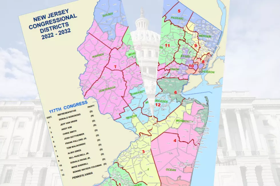
New Jersey's new congressional districts for the 2020s
Gallery Credit: Michael Symons
New Jersey's smallest towns by population
Gallery Credit: Michael Symons
More From Beach Radio