Big warmup for NJ Friday – foggy, showery, stormy, and windy too
Spring has sprung! And the first full day of the season is a pretty busy one here in the weather department. Warm, humid, windy, foggy, cloudy, showery, stormy, etc. Let's jump in as temperatures prepare to jump upward.
The main drivers of Friday's wild weather will be 1.) a warm front, followed by 2.) a cold front. With low-level moisture building in the atmosphere, pockets of dense fog have formed in New Jersey early Friday morning. A Dense Fog Advisory is posted for most of New Jersey until 9 a.m. with visibilities as low as a quarter-mile.
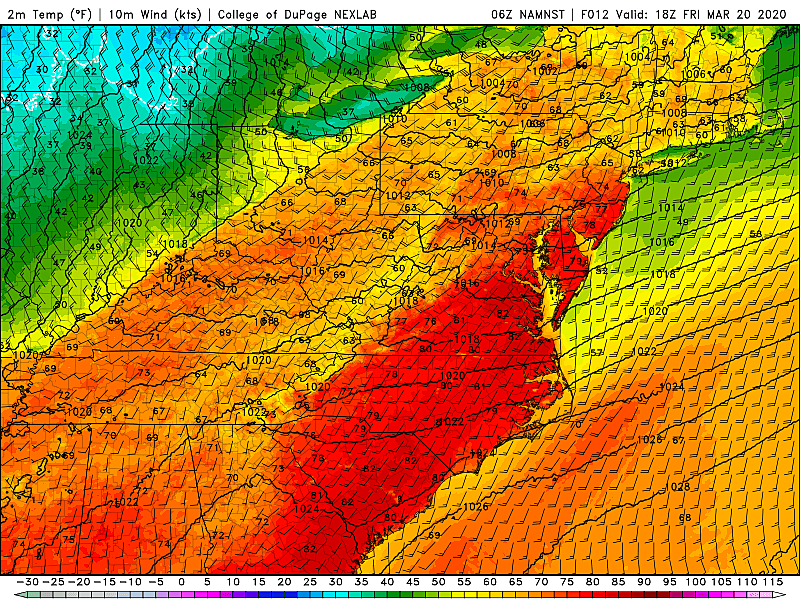
By mid-morning Friday, we'll really feel the effects of that warm front as temperatures begin rising rapidly. Thermometers will pop over 70 degrees around lunchtime. Highs will reach the lower to mid 70s for most of New Jersey Friday afternoon. It will be a bit cooler (60s) in far NW NJ and along the immediate coast. Meanwhile, 80 is a possibility for inland South Jersey. That is 20 to 30 degrees above normal for mid-late March!
Despite the warmth and humidity, it's going to be a rather unsettled day too. It will be windy at times, with potential gusts over 30 mph. Occasional rain showers will pass through the Garden State throughout both the morning and the afternoon. You'll probably get wet at some point, but it'll be far from a washout.
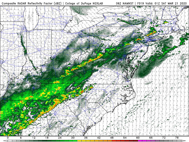
As we dive into Friday evening, the combination of warmth, humidity, and an approaching (strong) cold front will present a recipe for strong thunderstorms. I don't think this will be a concern until after 6 p.m. Friday. But keep an eye on the skya as that push of storms could produce gusty winds and heavy downpours. There is a non-zero chance of a quick tornadic spin-up too
Models are highly inconsistent regarding the end time of this final round of rain Friday night. GFS and Euro show us drying out well before dawn. The NAM, however, suggests one more disturbance riding along the front, delivering rain through mid-morning. So let's not rule out raindrops Saturday morning.
Skies will clear to bright sunshine by midday Saturday. But no more 70s — highs on Saturday will only reach about 50 degrees, just a hair below normal at this point of the year.
Sunday gets even cooler, and won't feel springlike at all. Morning lows below freezing, in the upper 20s. Afternoon highs only in the lower-mid 40s. At least we'll enjoy abundant sunshine for most of the day.
As our next storm system approaches, clouds will increase starting Sunday late afternoon. Showers may start to creep in by Sunday late evening.
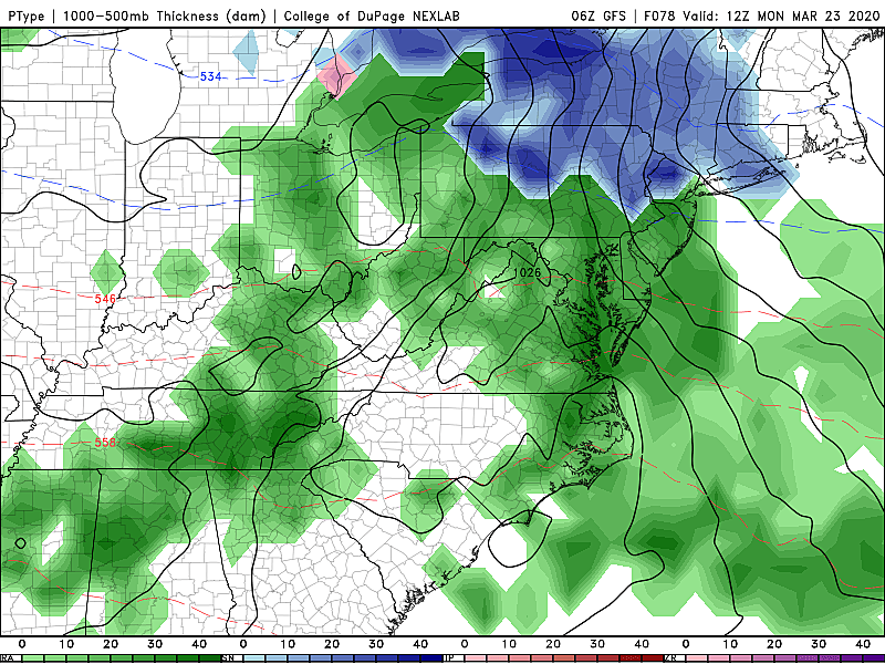
In general, Monday looks wet with periods of rain from early morning through early evening. In addition, temperatures will be borderline cold enough Monday morning to sustain some snow and/or wintry mix. I believe some snowflakes will be possible in the area north of Interstate 195 and west of Interstate 295. Maybe even some slippery spots and light accumulations in colder NW NJ. Although models have backed-off their previous ridiculous foot-plus solution, I'm still dubious about any substantial accumulation in New Jersey.
Still an interesting setup though, and worth watching through the weekend. (I'm sure the brine trucks are revving their engines.) If any travel-inhibiting snow/ice becomes likely, I will overcommunicate the updated forecast both on-air and online.
Have a great weekend. And stay healthy, my friends!
More From Beach Radio