Tracking 60-degree temperatures and accumulating snow for NJ
This wacky, hyperactive week of weather continues with rain, a warmup, a cooldown, and accumulating snow in the forecast for the Garden State.
Here are your weather headlines for Tuesday, February 7, 2017...
Rainy, but Warmer
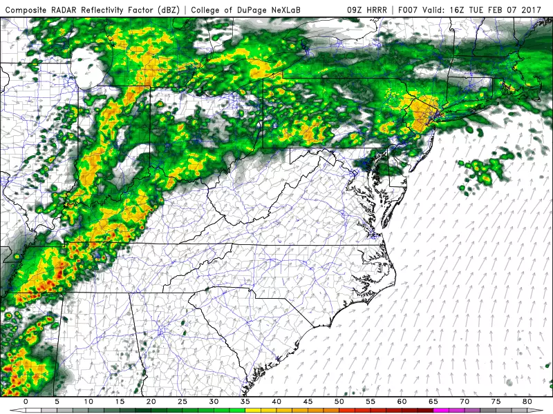
Tuesday is a warm front day! As the name implies, that means a warmup is underway. We have some rain on the way for Tuesday too.
Early Tuesday morning, temperatures are hovering right around the freezing mark in the higher elevations of North Jersey. So, as our first band of precipitation of the day arrives, some snowflakes and/or light freezing rain will be possible through about mid-morning. As of this writing, Sussex, Warren, and western Passaic counties remain under a Freezing Rain Advisory. But I suspect that advisory will be dropped early and icing impacts will be minimal, thanks to warming temperatures.
Periods of rain are expected throughout the daytime hours on Tuesday, definitely with breaks of dry weather along the way too (especially Tuesday afternoon). The steadiest rain will fall over northern and central New Jersey, with South Jersey likely limited to scattered showers.
Amidst the rain, high temperatures on Tuesday will bounce to about 50 degrees for North Jersey and near 60 degrees in South Jersey.
From Warm to Cool
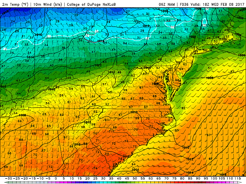
Temperatures will not drop much Tuesday night through Wednesday morning, as we experience one more round of rain and a stiff breeze increasing overnight. Wednesday's high temperature will occur in the morning, likely peaking in the lower to mid 60s for the bulk of New Jersey. That will be 20+ degrees above normal, and close to the daily record high temperatures.
Don't get used to the warmth, of course. A strong cold front will push through New Jersey around midday Wednesday. While the frontal passage will be dry, it will cause temperatures to begin dropping sharply Wednesday afternoon.
Sloppy Thursday Morning
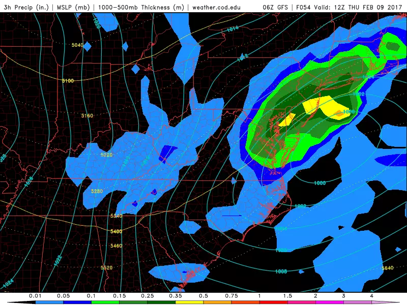
Confidence is rising that we are going to see accumulating snow for part of New Jersey on Thursday morning. Some news outlets are already touting "significant" snow - but I'm not ready to go there quite yet. While we're starting to get better resolution on this forecast, there are still some big hesitations and question marks. Let's talk about what we know (and what we think we know)...
Timing? As usual, the storm's timing is the first piece of information we can make a call on with moderate to high confidence. First snowflakes (and raindrops) are expected late Wednesday evening (after 10 p.m.) The peak of the storm will coincide with Thursday morning's rush hour, around 7 a.m. Snowfall and rainfall will taper off considerably by Thursday late morning (after 10 a.m.) Lingering showers may persist through Thursday evening.
Track? The center of this storm system will pass south and east of New Jersey. The closer we are to the core of this low pressure system, and the stronger (deeper) it is, the heavier the precipitation will be. These dynamics will be very important in estimating snowfall rates and ultimate snowfall totals.
Temperatures? The biggest, more critical question mark of all. As temperatures tumble through Wednesday night, it will eventually get cold enough to sustain all snow in northern and maybe central New Jersey. However, I suspect the rain-mix-snow transition line will be stuck right on top of New Jersey at some point. That makes this forecast incredibly difficult (if not impossible) to pinpoint.
Totals? Pick a number between 0 and 10. As this forecast has evolved so far this week, I've literally seen snow forecasts ranging from 0 to 10 inches. Unfortunately, we still don't have great consensus among the forecast models as of Tuesday morning. The NAM shows the highest totals, with 6 to 9 inches across the northern third of New Jersey. The GFS is at the low end, with more a piddly 3 inch bullseye in Central Jersey. The Euro model goes in a completely different direction, painting a consistent area of 4 to 5 inch totals across the entire Garden State. (The Euro notably shows the deepest low pressure too.) Also keep in mind, I'm not convinced these model snowfall totals adequately capture the temperature difficulties I noted above.
Snow Map? I've decided that I'm not comfortable enough to publish a detailed snow forecast map yet - when in doubt, I much prefer to be right than first. I will say that 4+ inches looks likely for areas north and west of the NJ Turnpike. At least. I'm leaving the door open for scenarios that involve both higher and lower totals in the end.
Bottom Line? Whether it's snow, rain, or something in between, Thursday morning is going to get quite sloppy across the entire Garden State. The timing of this system is poor, as the peak of the storm will occur during prime commute time.
We'll continue to fill in the blanks on this forecast in the coming hours and days. My best advice for right now would be to prepare for the worst (4+ inch snowfall) and keep a close eye and ear on the latest forecast.
More From Beach Radio