

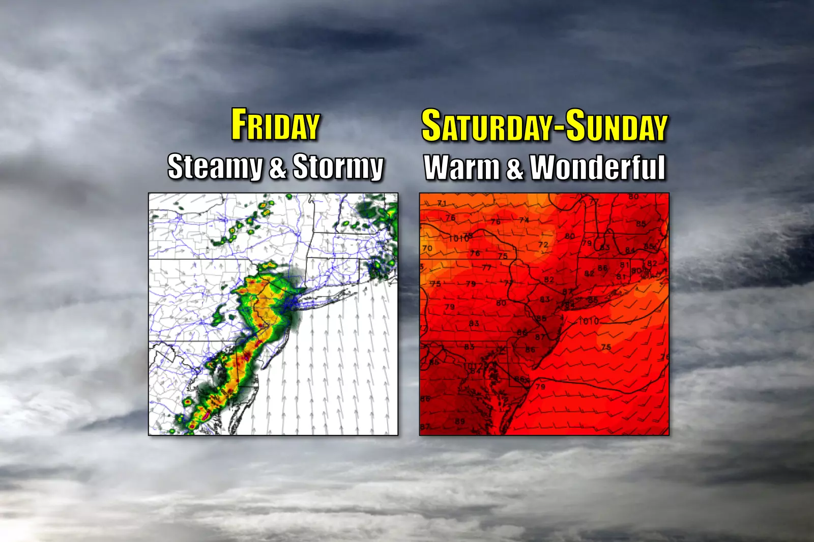
Steamy and stormy Friday, sunny and summery weekend
SEVERE THUNDERSTORM WATCH issued for the entire state until 9 p.m. Friday.
Several rounds of thunderstorms will be fueled by ridiculous humidity through Friday evening, but the weekend forecast is sunny, warm, and more comfortable.
Here are your weather headlines for Friday, August 18, 2017...
Friday: Steamy and Stormy
Are you ready for a dose of truly horrendous humidity? While muggy weather is a trademark of the summer here in New Jersey, it's going to get really really uncomfortable today. Dew points may be as high as 77 or 78 — yuck!
It's already sticky Friday morning, with temperatures already in the 70s. High temperatures will climb into the mid 80s today, with heat index ("feels like" temperatures) potentially topping 90 degrees. Air conditioning will be your friend.
Meanwhile, several rounds of showers and thunderstorms are expected throughout Friday. The first is pushing into NW NJ as of this writing, and will progress across the state through mid-to-late morning. At the moment, it looks like it will only impact the northern half of New Jersey, but we'll have to wait and see if additional shower development occurs over South Jersey.
From late morning through much of the afternoon, we'll see a bit of a lull in the rainfall action, with isolated thunderstorms possible. Then, look out for one final round of strong thunderstorms from late afternoon through late evening.
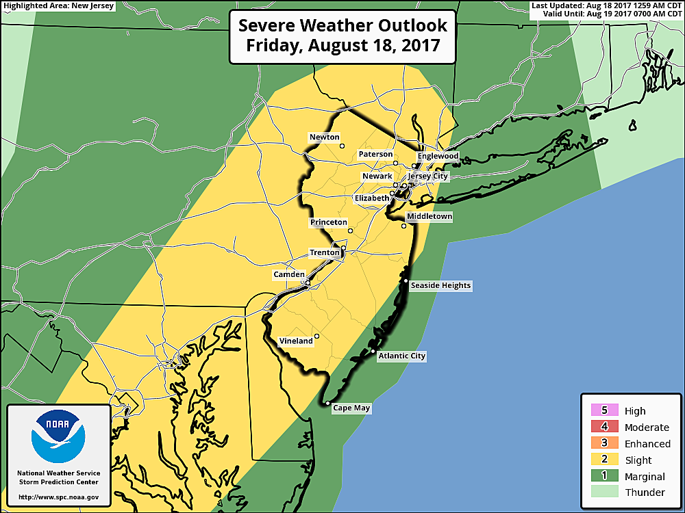
Each round of storms will be capable of producing very heavy rainfall, with localized rainfall totals over 2 inches by the end of the day. A Flash Flood Watch has been issued from 2 p.m. to Midnight for all or part of 12 NJ counties: northwestern Burlington, Camden, Gloucester, Hunterdon, Mercer, Middlesex, western Monmouth, Morris, Salem, Somerset, Sussex, and Warren.
In addition, most of New Jersey (away from the coast) has landed in a Slight Risk of severe weather on Friday. (That's level 2 of 5.) The Storm Prediction Center puts severe weather odds at 15% for wind, <5% for hail, and 2% for a tornado.
Saturday: Summerlike
By Midnight Friday night, thunderstorms will exit the Garden State. Lingering showers will accompany clearing skies overnight. It's still going to be sticky, as low temperatures again only fall into the lower 70s.
While you'll probably wake up to some clouds Saturday morning, sunshine will take over the sky by around midday. Humidity levels will drop steadily throughout the day. And temperatures will be nice and warm, peaking in the upper 80s to around 90 degrees by Saturday afternoon.
If you've been craving a hot, mostly sunny summer afternoon, Saturday looks like a winner.
Sunday: Also Summerlike
Hey, Sunday looks good too!
Mostly sunny skies, light winds, reasonable humidity, and warm temperatures in the mid to upper 80s. Awesome.
Having said that, a very weak impulse is expected to pass over the Garden State sometime Saturday night-Sunday morning. We could see a few sprinkles or showers. But the chance is so low, I'm still not even mentioning this chance on-air.
Monday: Eclipse Day
The forecast for next week looks hot and somewhat unsettled. While Monday will begin with sunshine, we'll see clouds increase throughout the day. By solar eclipse time Monday afternoon, skies will probably be partly to mostly cloudy. Not ideal. But I'm confident there will be breaks in the clouds — hopefully enough to view the partial eclipse here in New Jersey.
More From Beach Radio


