
Christmas weekend weather: A bit of rain, otherwise fine
No widespread wintry weather and no major travel disruptions are expected for the holiday weekend, but the weather won't be perfect either.
UPDATE as of 4:30 p.m. Friday...
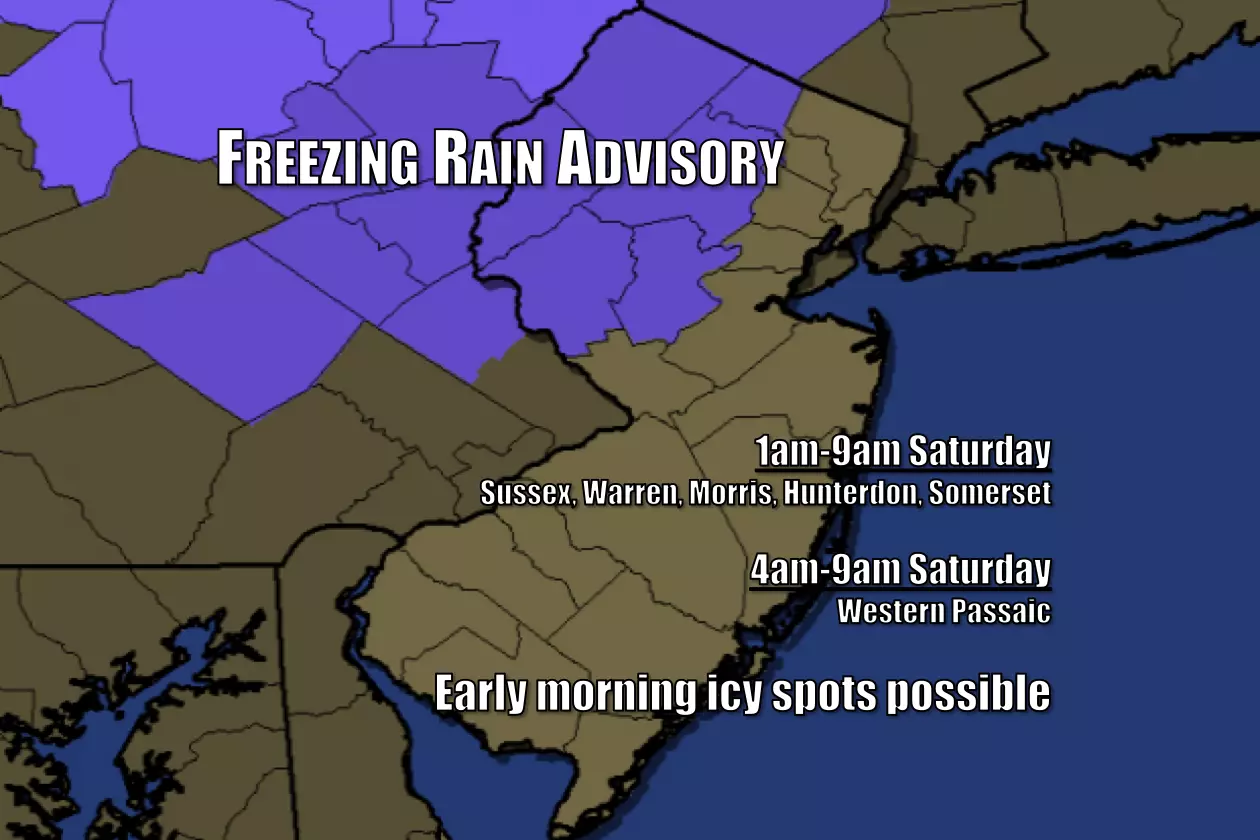
The National Weather Service has issued a Freezing Rain Advisory for six counties in New Jersey for early Saturday morning. This means icy spots will be possible due to freezing rain.
Again, it's limited to NW NJ. As I've been saying for days, I'm not worried about travel disruptions due to wintry mix and/or the "liquid" rain that will follow Saturday. Just be aware that it might be slippery early Saturday.
If you're really concerned, delay travel until after 9am.
Original Post as of 6:01 a.m. Friday...
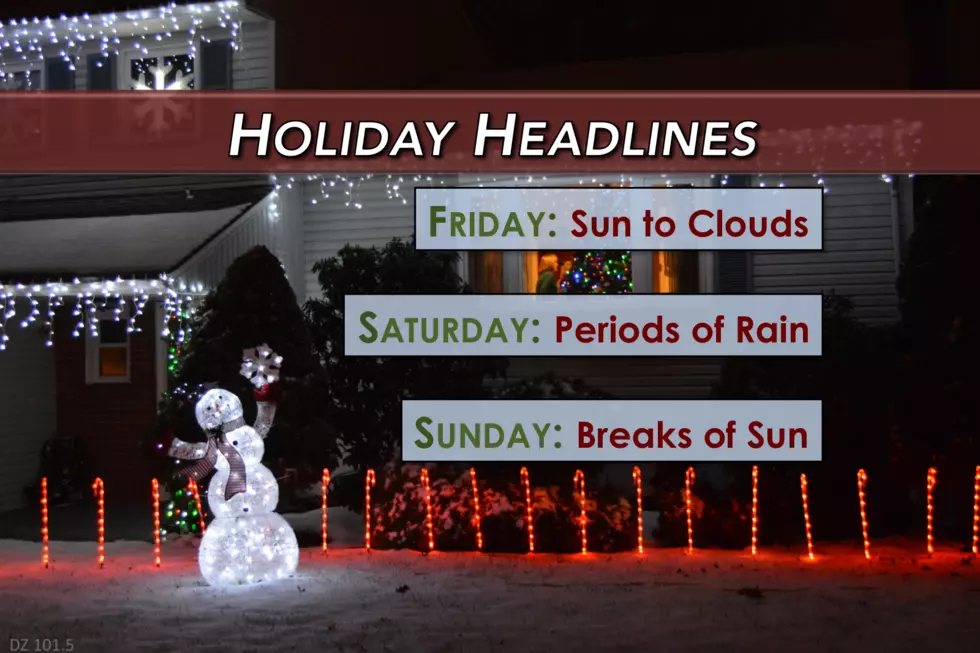
Here are your weather headlines for Friday, December 23, 2016...
We Wish You a Sunny Friday
The next few days will be filled with traveling, shopping, and merriment all around. And, on average, the weather won't be too bad as we dive into the last full weekend of the year.
Friday is starting off comfortably cool, with morning low temperatures in the upper 20s to mid 30s. We'll make it to the upper 40s to around 50 degrees by Friday afternoon, perhaps a few degrees cooler than Thursday. Mostly sunny skies will last for most of the day, before clouds start to increase around the mid-afternoon hours (from 3 p.m. on).
I've been branding Friday as a very nice late December day, and I still stand by that description.
Baby, It's Wet Outside
It's not all sugar plums for the weekend though, as a storm system will track directly across New Jersey from Friday night through Saturday (Christmas Eve). Initially, scattered showers will spread from west to east, possibly as early as 7 p.m. Friday evening. This precipitation will be almost exclusively rain and, given our bone dry air it is likely to be light (or not make it to the ground at all).
As thermometers dip to about 30 to 32 degrees in North Jersey on Saturday morning, there could be some snowflakes and icy patches in the mix. The wintry weather threat is low, and really should not cause any big problems for holiday travel in the Garden State. Especially as high temperatures on Saturday climb to the 40s and 50s, well above freezing across all regions of N.J.
Models show the rain will become steadier by about 7 a.m. Saturday. The heaviest rain looks to fall midday Saturday, from about 10 a.m. to 2 p.m. - so plan accordingly, and keep an umbrella handy. Statewide rainfall totals should end up between a quarter-inch and half-inch, not particularly drenching but enough to call Saturday a wet day overall.
By 4 p.m. Saturday, our weather will begin to dry out and clear out. Good news for the first night of Hanukkah - sunset on Saturday will occur around 4:38 p.m.
And it's good news for Santa's big arrival too! Midnight Christmas Eve will feature mostly clear skies with temperatures falling into the 30s.
All I Want for Christmas is Sun
Dreaming of a White Christmas? Keep dreaming...
Christmas Day will feature a return to pleasant, quiet late December weather. Models disagree a bit on cloud cover - the GFS and Euro show abundant sunshine, while the NAM keeps stubborn clouds on top of the Garden State. OK so, at worst, it will be partly sunny. At best, it will be sunny. High temperatures on Sunday afternoon should hold steady in the upper 40s to around 50 degrees.
The quiet weather will continue into Monday, before a chance for a few showers early Tuesday morning. While the last week of 2016 will start off warm, we'll likely experience a cooldown by New Year's weekend. Exactly when that chill arrives, and how cool it's going to get? Still up in the air.
No matter which holiday(s) you're celebrating this weekend, I hope it's filled with family, food, fun, peace, and love. (The MDZ weather blog will return on Tuesday.)
More From Beach Radio


